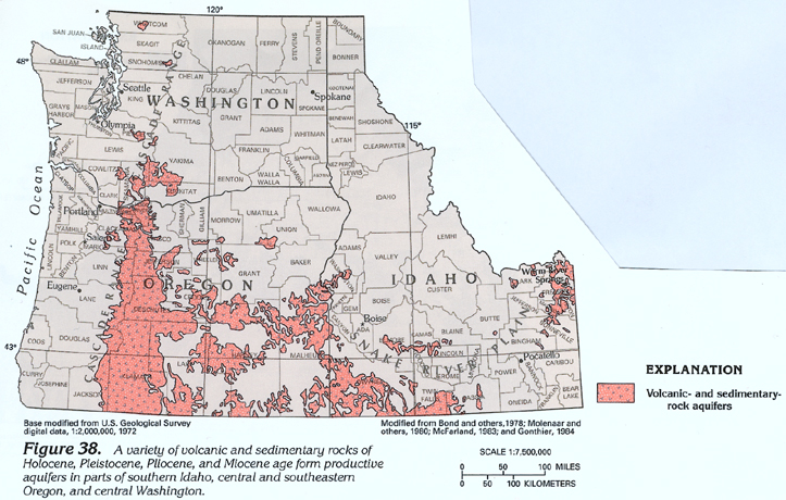
Volcanic- and sedimentary-rock aquifers (fig. 38) consist of a variety of volcanic and sedimentary rocks. These aquifers are not as productive as the unconsolidated-deposit, Pliocene and younger basaltic-rock, or Miocene basaltic-rock aquifers. Volcanic- and sedimentary-rock aquifers generally yield freshwater but locally yield saltwater. About 30 percent of the fresh ground-water withdrawals are used for public-supply, about 20 percent are used for domestic and commercial, and about 50 percent are used for agricultural (primarily irrigation) purposes.
The volcanic rocks that compose the aquifers consist primarily of Pliocene and younger basaltic rocks on the eastern side of the Cascade Range in Oregon and Washington and silicic volcanic rocks in southern Idaho and southeastern Oregon; unconsolidated volcanic deposits included in the aquifers are ash and cinders. The sedimentary rocks that compose the aquifers consist primarily of semiconsolidated sand and gravel eroded mostly from volcanic rocks. In some places, the aquifers might consist of a single rock type; in other places, the aquifers might consist of several interbedded rock types.>
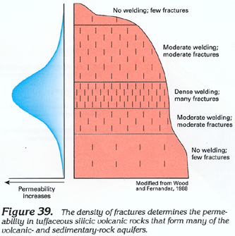
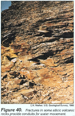
The permeability of the various rocks that compose the aquifers is extremely variable. Interflow zones and faults in basaltic lava flows; fractures in tuffaceous, welded silicic volcanic rocks (figs. 39 and 40); and interstices in coarse ash, sand, and gravel mostly yield less than 100 gallons per minute of water to wells. Rarely, wells will yield several thousand gallons per minute. Where major faults are present, the rocks commonly contain geothermal water under confined conditions.
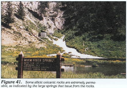
Silicic volcanic rocks in northeastern Idaho are extremely permeable in places, as indicated by the large springs that issue from these rocks (fig. 41). Specific-capacity values of wells completed in these rocks range from 1 to 2,000 gallons per minute per foot of drawdown but commonly are less than 400 gallons per minute per foot of drawdown. The known thickness of these rocks is about 3,000 feet.
The hydrogeologic characteristics of the volcanic- and sedimentary-rock aquifers are largely unknown in many places because they are in remote areas where the demand for ground water is small. Also, the subsurface extent of these aquifers is largely unknown because of limited outcrop areas where they are shown overlying older rocks or because they are too deep for wells to reach economically. However, in some areas, deep wells (500 to 2,000 feet) drilled chiefly for geothermal water, such as in Boise, Idaho, and in places along the southern margin of the Snake River Plain in southwestern Idaho, have penetrated these aquifers.