GROUND WATER ATLAS of the UNITED STATES
Montana, North Dakota, South Dakota, Wyoming
HA 730-I
Regional aquifer systems
There are two different files for each illustration
- A 72 ppi GIF file, suitable for screen viewing is accessed through
the thumbnail image
- An eps file, suitable for downloading to be printed or edited is accessed
through the "eps file" link. Most files are Adobe Illustrator
6.0, exceptions are noted. These files have been compressed with GNU's
gzip utility. If your web browser defaults to a screen display of the file,
turn on the "Load to local disk" option before downloading. Download
and process these eps files as ascii, not binary.
High Plains aquifer system
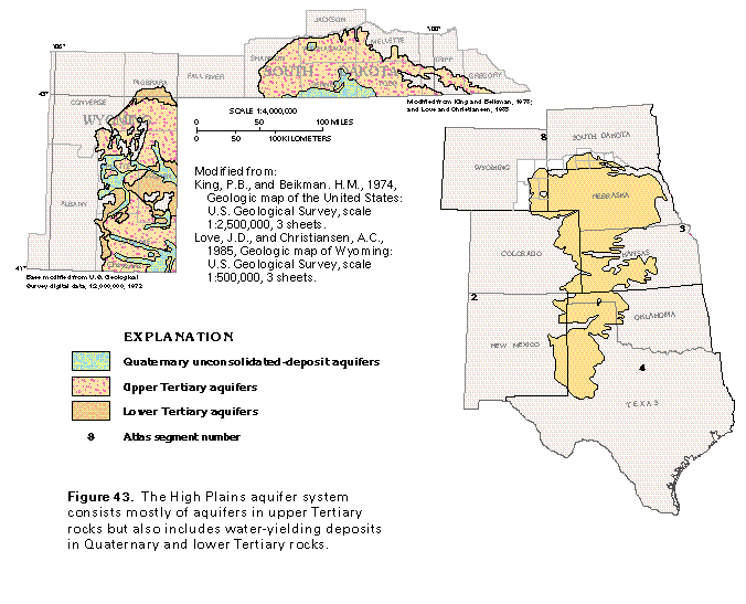
Figure 43 Map of aquifers in the High Plains aquifer system (33K)
 editable eps
file I043.eps.gz (248K compressed)
editable eps
file I043.eps.gz (248K compressed)
Figure 44 Correlation chart (17K)
 editable eps
file I044.eps.gz (50K compressed)
editable eps
file I044.eps.gz (50K compressed)
Figure 45 Map of depth to water (17K)
 editable eps
file I045.eps.gz (149K compressed)
editable eps
file I045.eps.gz (149K compressed)
Figure 46 Map of saturated thickness (17K)
 editable eps
file I046.eps.gz (149K compressed)
editable eps
file I046.eps.gz (149K compressed)
Figure 47 Map of hydraulic head (17K)
 editable eps
file I047.eps.gz (116K compressed)
editable eps
file I047.eps.gz (116K compressed)
Figure 48 Map of hydraulic conductivity (17K)
 editable eps
file I048.eps.gz (149K compressed)
editable eps
file I048.eps.gz (149K compressed)
 editable eps
file I043.eps.gz (248K compressed)
editable eps
file I043.eps.gz (248K compressed) 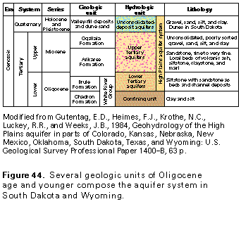 editable eps
file I044.eps.gz (50K compressed)
editable eps
file I044.eps.gz (50K compressed) 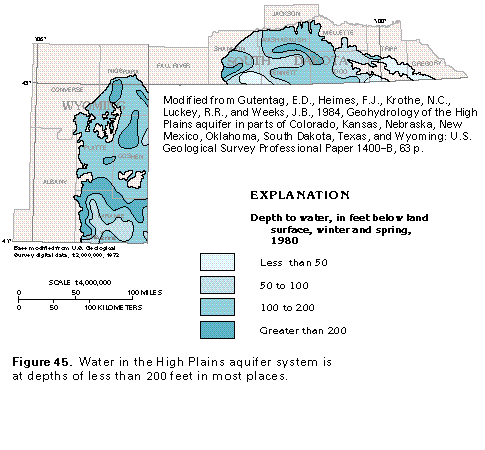 editable eps
file I045.eps.gz (149K compressed)
editable eps
file I045.eps.gz (149K compressed) 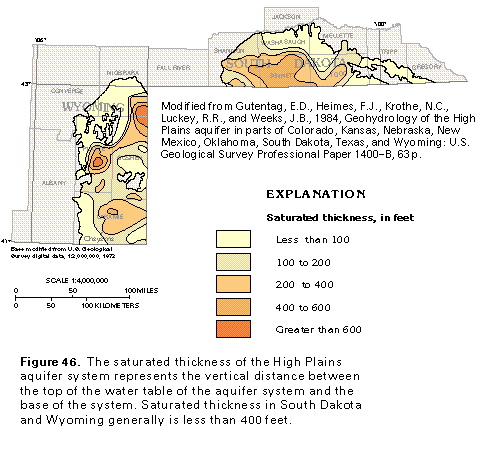 editable eps
file I046.eps.gz (149K compressed)
editable eps
file I046.eps.gz (149K compressed) 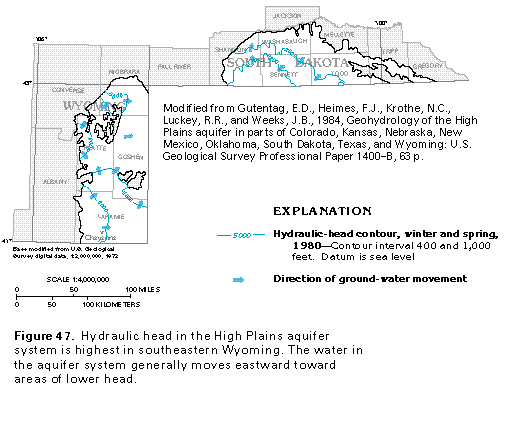 editable eps
file I047.eps.gz (116K compressed)
editable eps
file I047.eps.gz (116K compressed) 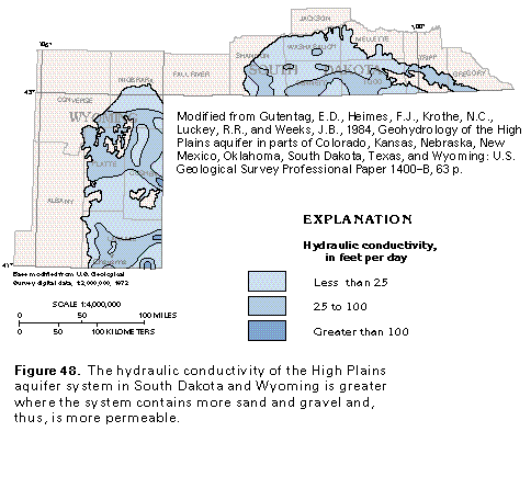 editable eps
file I048.eps.gz (149K compressed)
editable eps
file I048.eps.gz (149K compressed)