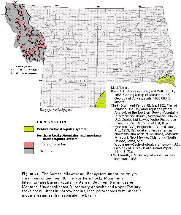
Figure 74 Map of the aquifer system (50K)
 editable eps
file I074.eps.gz (215K compressed)
editable eps
file I074.eps.gz (215K compressed)
Figure 74 Map of the aquifer system (50K)
editable eps
file I074.eps.gz (215K compressed)
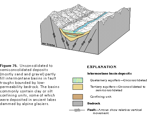 This illustration contains
a placed image. Download the Adobe Illustrator 6 eps
file I075.eps.gz (99K compressed) which contains an imbedded Adobe Photoshop
3 (eps) file. You may also want to download the editable
Photoshop file I075psh.eps.gz (116K compressed)
This illustration contains
a placed image. Download the Adobe Illustrator 6 eps
file I075.eps.gz (99K compressed) which contains an imbedded Adobe Photoshop
3 (eps) file. You may also want to download the editable
Photoshop file I075psh.eps.gz (116K compressed) 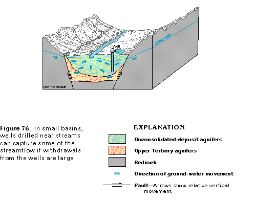 This illustration contains
a placed image. Download the Adobe Illustrator 6 eps
file I076.eps.gz (99K compressed) which contains an imbedded Adobe Photoshop
3 (eps) file. You may also want to download the editable
Photoshop file I076psh.eps.gz (99K compressed)
This illustration contains
a placed image. Download the Adobe Illustrator 6 eps
file I076.eps.gz (99K compressed) which contains an imbedded Adobe Photoshop
3 (eps) file. You may also want to download the editable
Photoshop file I076psh.eps.gz (99K compressed) 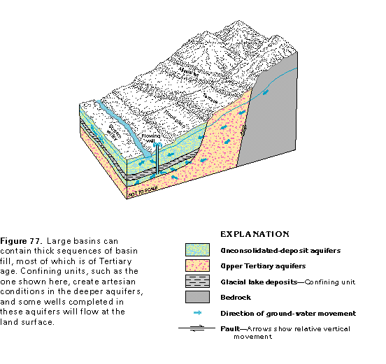 This illustration contains
a placed image. Download the Adobe Illustrator 6 eps
file I077.eps.gz (149K compressed) which contains an imbedded Adobe
Photoshop 3 (eps) file. You may also want to download the editable
Photoshop file I077psh.eps.gz (215K compressed)
This illustration contains
a placed image. Download the Adobe Illustrator 6 eps
file I077.eps.gz (149K compressed) which contains an imbedded Adobe
Photoshop 3 (eps) file. You may also want to download the editable
Photoshop file I077psh.eps.gz (215K compressed)