GROUND WATER ATLAS of the UNITED STATES
Montana, North Dakota, South Dakota, Wyoming
HA 730-I
Regional summary
There are two different files for each illustration
- A 72 ppi GIF file, suitable for screen viewing is accessed through
the thumbnail image
- An eps file, suitable for downloading to be printed or edited is accessed
through the "eps file" link. Most files are Adobe Illustrator
6.0, exceptions are noted. These files have been compressed with GNU's
gzip utility. If your web browser defaults to a screen display of the file,
turn on the "Load to local disk" option before downloading. Download
and process these eps files as ascii, not binary.
Introduction
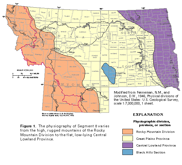
Figure 1 Map of physiography (50K)
 editable eps
file I001.eps.gz (281K compressed)
editable eps
file I001.eps.gz (281K compressed)
Figure 2 Map of land ownership (50K)
 editable eps
file I002.eps.gz (330K compressed)
editable eps
file I002.eps.gz (330K compressed)
Figure 3 Map of land irrigation (50K)
 editable eps
file I003.eps.gz (693K compressed)
editable eps
file I003.eps.gz (693K compressed)
Figure 4 Map of precipitation (33K)
 editable eps
file I004.eps.gz (149K compressed)
editable eps
file I004.eps.gz (149K compressed)
Figure 5 Map of runoff (50K)
 editable eps
file I005.eps.gz (149K compressed)
editable eps
file I005.eps.gz (149K compressed)
 editable eps
file I001.eps.gz (281K compressed)
editable eps
file I001.eps.gz (281K compressed) 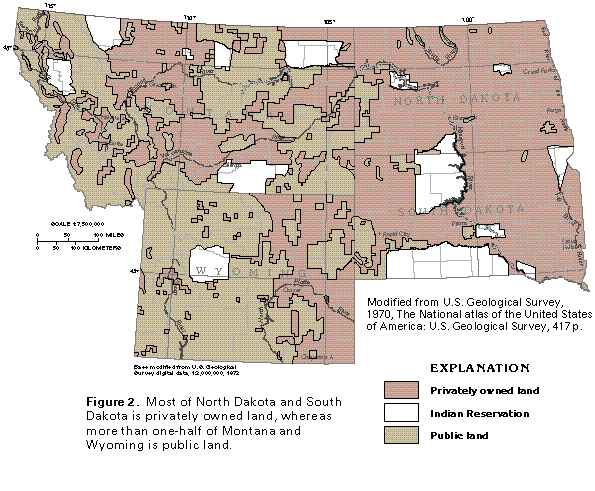 editable eps
file I002.eps.gz (330K compressed)
editable eps
file I002.eps.gz (330K compressed) 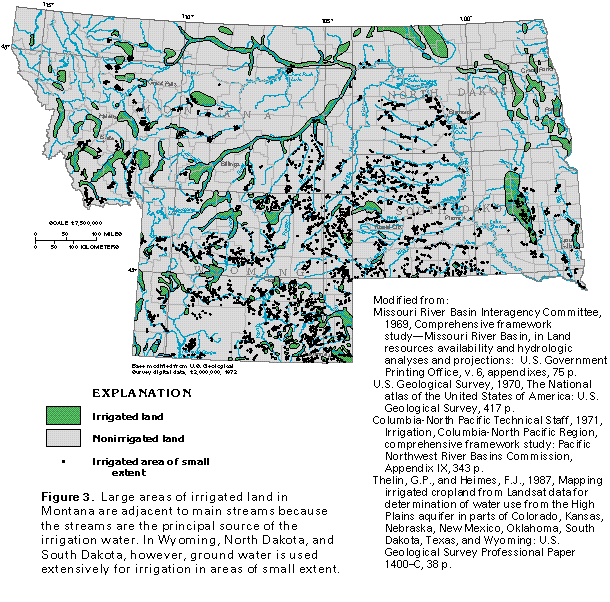 editable eps
file I003.eps.gz (693K compressed)
editable eps
file I003.eps.gz (693K compressed) 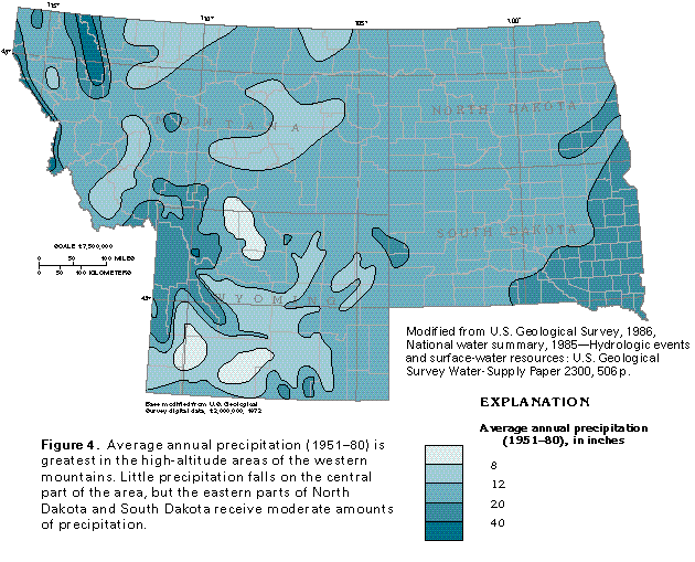 editable eps
file I004.eps.gz (149K compressed)
editable eps
file I004.eps.gz (149K compressed) 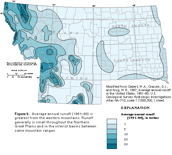 editable eps
file I005.eps.gz (149K compressed)
editable eps
file I005.eps.gz (149K compressed)