GROUND WATER ATLAS of the UNITED STATES
Iowa, Michigan, Minnesota, Wisconsin
HA 730-J
Regional summary
There are two different files for each illustration
- A 90 ppi JPEG file, suitable for screen viewing is accessed
through the thumbnail image
- A tiff file is accessed through the "tiff file"
link. All files are Adobe Photoshop. These files have been compressed
with GNU's gzip utility. If your web browser defaults to a screen
display of the file, turn on the "Load to local disk"
option before downloading. Download and process these tiff files
as ascii, not binary.
Location and Extent of Major Aquifer Systems and Aquifers
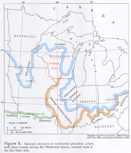
Figure 5 Map showing advances of glaciation (231K)
 downloadable tiff file J005.tif.gz (1.8MB
compressed)
downloadable tiff file J005.tif.gz (1.8MB
compressed)
Figure 6 Map showing glacial meltwater deposits (773K)
 downloadable
tiff file J006.tif.gz (15MB
compressed)
downloadable
tiff file J006.tif.gz (15MB
compressed)
Figure 7 Map showing aquifers and confining unit areas
in Segment 9 (872K)
 downloadable
tiff file J007.tif.gz (42MB
compressed)
downloadable
tiff file J007.tif.gz (42MB
compressed)
Figure 8 Correlation chart showing aquifers and confining
units listed by state and grouped into hydrogeologic units (267K)
 downloadable
tiff file J008.tif.gz (3.9MB
compressed)
downloadable
tiff file J008.tif.gz (3.9MB
compressed)
 downloadable tiff file J005.tif.gz (1.8MB
compressed)
downloadable tiff file J005.tif.gz (1.8MB
compressed) 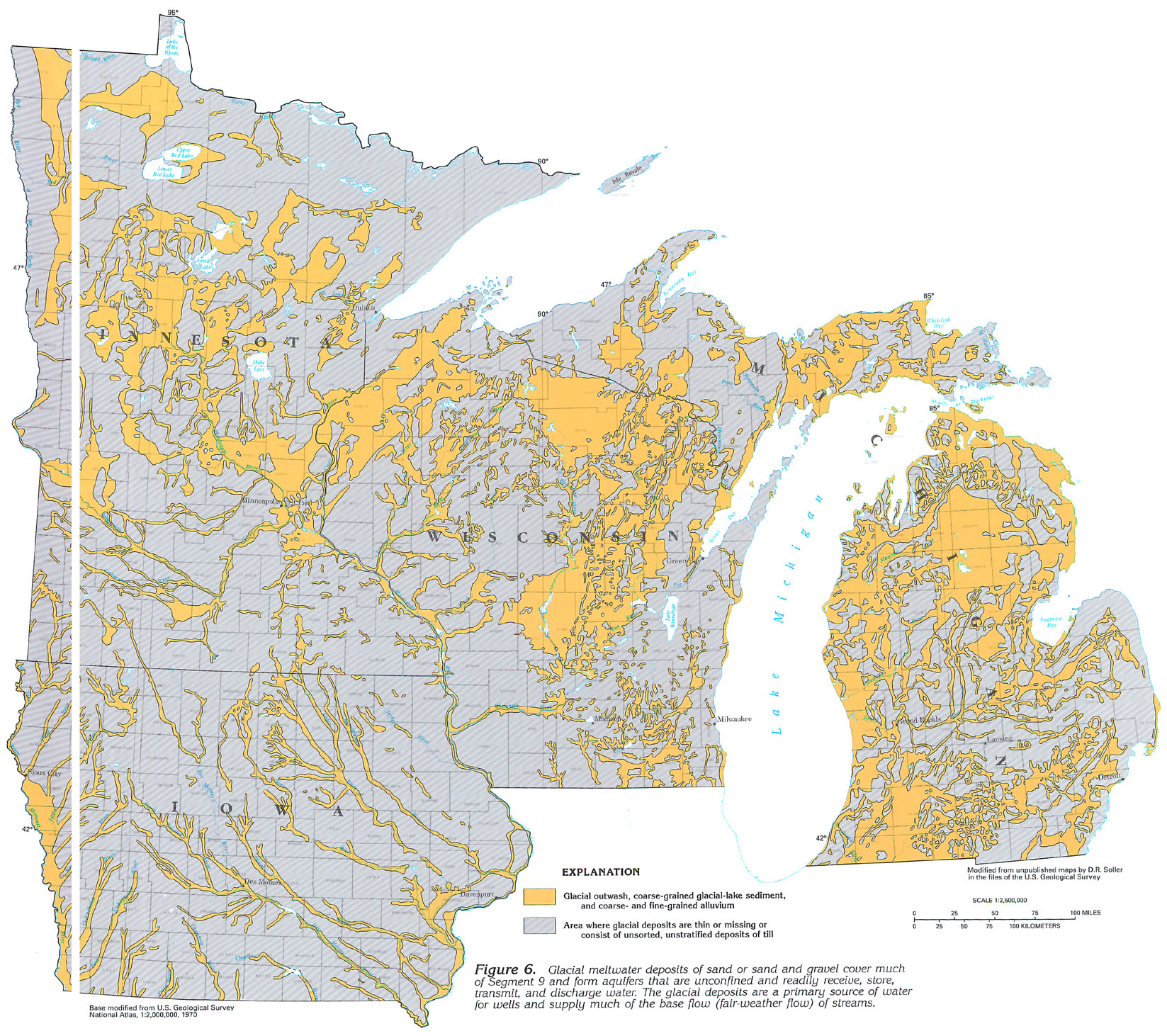 downloadable
tiff file J006.tif.gz (15MB
compressed)
downloadable
tiff file J006.tif.gz (15MB
compressed) 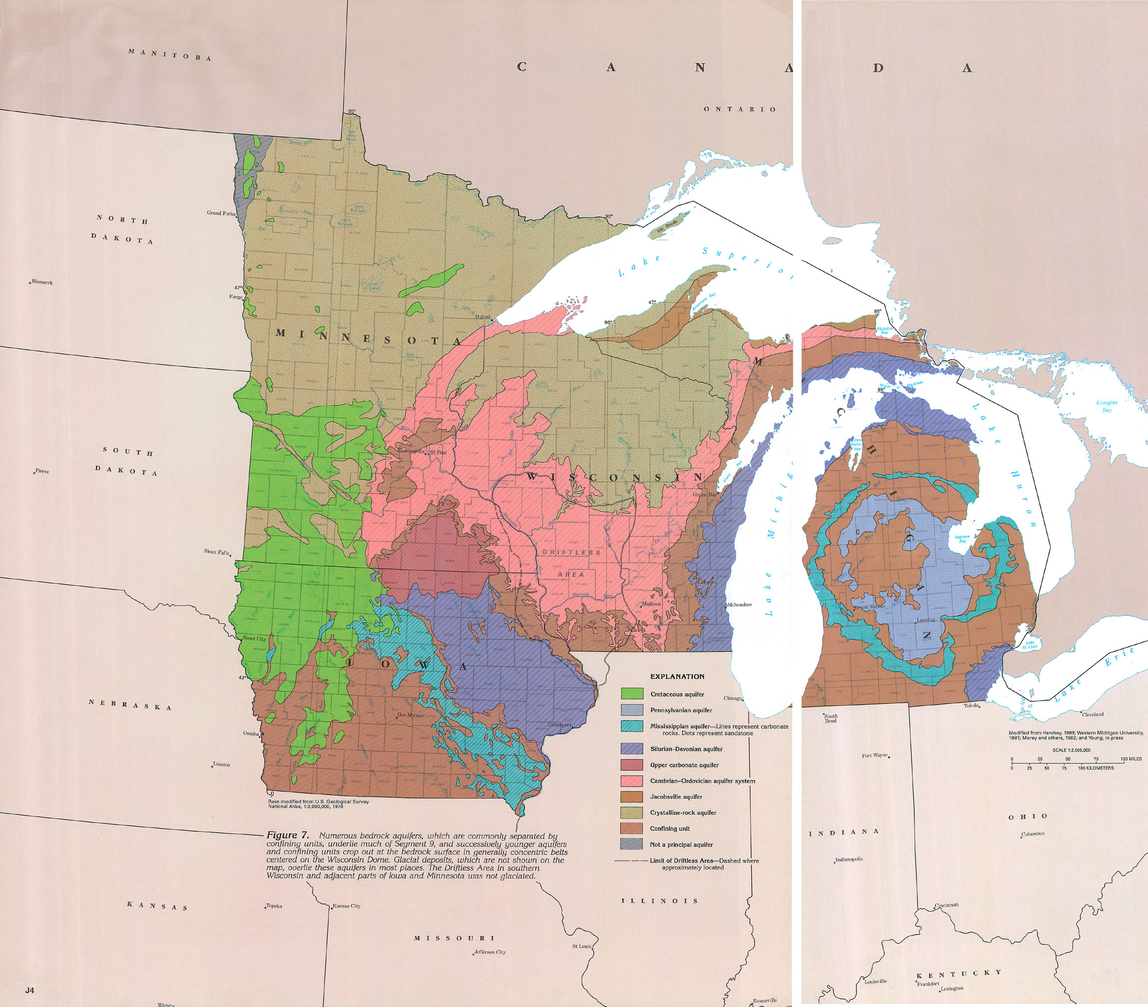 downloadable
tiff file J007.tif.gz (42MB
compressed)
downloadable
tiff file J007.tif.gz (42MB
compressed) 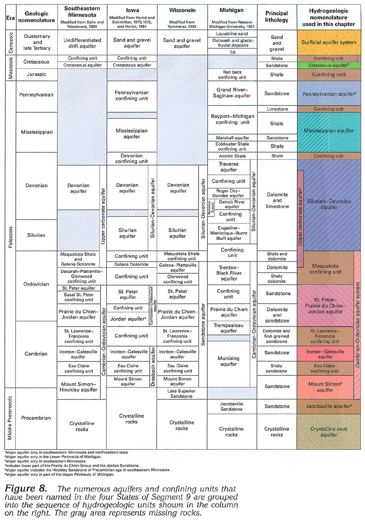 downloadable
tiff file J008.tif.gz (3.9MB
compressed)
downloadable
tiff file J008.tif.gz (3.9MB
compressed)