GROUND WATER ATLAS of the UNITED STATES
Iowa, Michigan, Minnesota, Wisconsin
HA 730-J
Surficial aquifer system
There are two different files for each illustration
- A 90 ppi JPEG file, suitable for screen viewing is accessed
through the thumbnail image.
- A tiff file is accessed through the "tiff file"
link. All files are Adobe Photoshop. These files have been compressed
with GNU's gzip utility. If your web browser defaults to a screen
display of the file, turn on the "Load to local disk"
option before downloading. Download and process these tiff files
as ascii, not binary.
Introduction
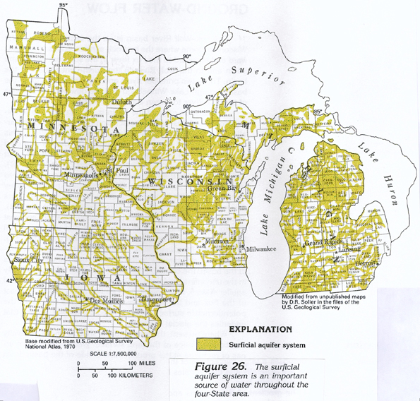
Figure 26 Map showing location of the surficial aquifer
system in Segment 9 (398K)
 downloadable tiff file J026.tif.gz (2.8MB
compressed)
downloadable tiff file J026.tif.gz (2.8MB
compressed)
Figure 27 Photograph showing sorted and
stratified deposits of sand and gravel (166K)
 downloadable tiff file J027.tif.gz (1.5MB
compressed)
downloadable tiff file J027.tif.gz (1.5MB
compressed)
 downloadable tiff file J026.tif.gz (2.8MB
compressed)
downloadable tiff file J026.tif.gz (2.8MB
compressed) 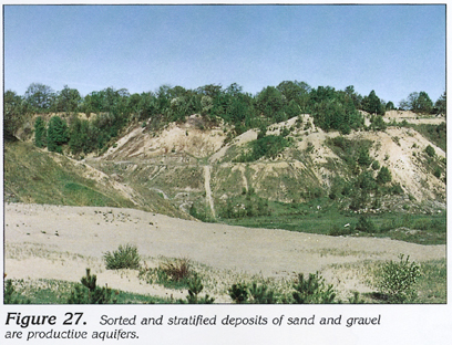 downloadable tiff file J027.tif.gz (1.5MB
compressed)
downloadable tiff file J027.tif.gz (1.5MB
compressed)