GROUND WATER ATLAS of the UNITED STATES
Iowa, Michigan, Minnesota, Wisconsin
HA 730-J
Surficial aquifer system
There are two different files for each illustration
- A 90 ppi JPEG file, suitable for screen viewing is accessed
through the thumbnail image.
- A tiff file is accessed through the "tiff file"
link. All files are Adobe Photoshop. These files have been compressed
with GNU's gzip utility. If your web browser defaults to a screen
display of the file, turn on the "Load to local disk"
option before downloading. Download and process these tiff files
as ascii, not binary.
Geology and Water-yielding Characteristics
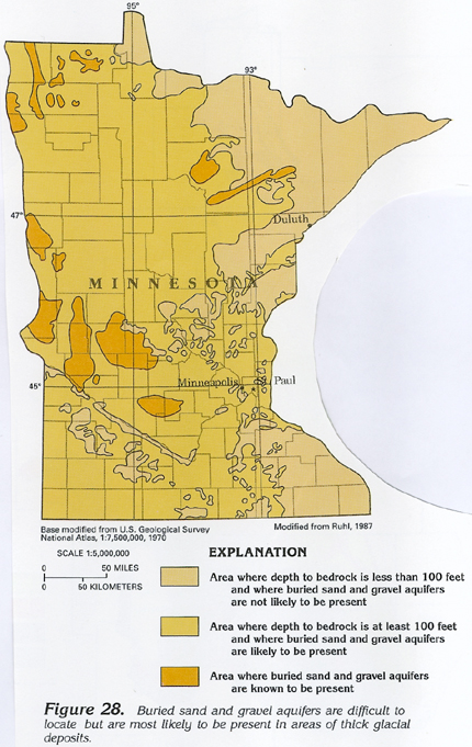
Figure 28 Map showing location of buried sand and gravel
aquifers in Minnesota (281K)
 downloadable tiff file J028.tif.gz (2.4MB
compressed)
downloadable tiff file J028.tif.gz (2.4MB
compressed)
Figure 29 Map showing composition of important
surficial aquifers in central Iowa (201K)
 downloadable tiff file J029.tif.gz (1.6MB
compressed)
downloadable tiff file J029.tif.gz (1.6MB
compressed)
Figure 30 Map showing thickness of surficial
deposits in Segment 9 (430K)
 downloadable tiff file J030.tif.gz
(6MB compressed)
downloadable tiff file J030.tif.gz
(6MB compressed)
 downloadable tiff file J028.tif.gz (2.4MB
compressed)
downloadable tiff file J028.tif.gz (2.4MB
compressed) 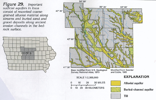 downloadable tiff file J029.tif.gz (1.6MB
compressed)
downloadable tiff file J029.tif.gz (1.6MB
compressed) 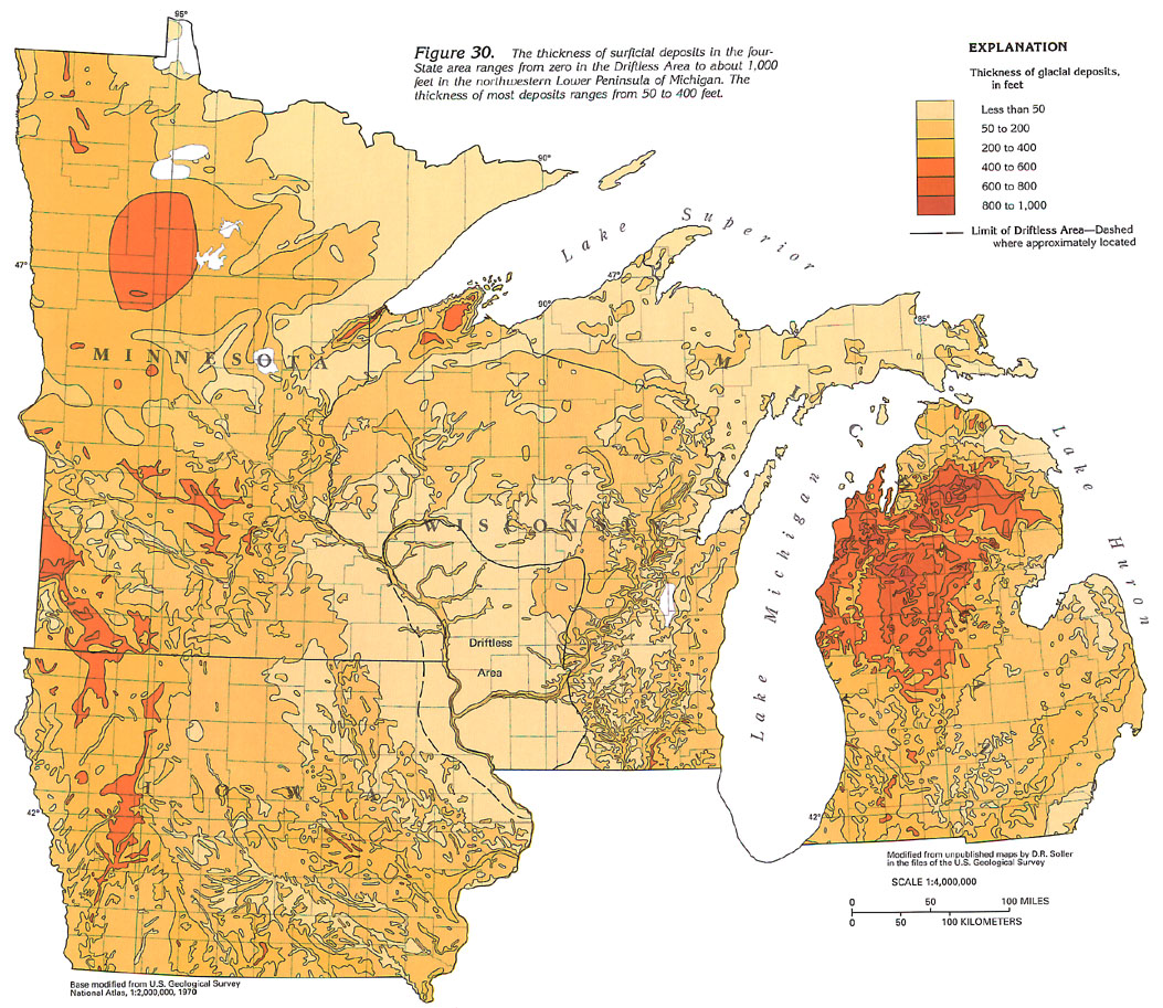 downloadable tiff file J030.tif.gz
(6MB compressed)
downloadable tiff file J030.tif.gz
(6MB compressed)