GROUND WATER ATLAS of the UNITED STATES
Iowa, Michigan, Minnesota, Wisconsin
HA 730-J
Surficial aquifer system
There are two different files for each illustration
- A 90 ppi JPEG file, suitable for screen viewing is accessed
through the thumbnail image.
- A tiff file is accessed through the "tiff file"
link. All files are Adobe Photoshop. These files have been compressed
with GNU's gzip utility. If your web browser defaults to a screen
display of the file, turn on the "Load to local disk"
option before downloading. Download and process these tiff files
as ascii, not binary.
Ground-water Flow
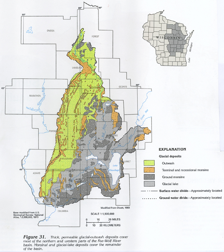
Figure 31 Map showing location of glacial-outwash deposits in
the Fox-Wolf River basin (458K)
 downloadable tiff file J031.tif.gz (4.4MB
compressed)
downloadable tiff file J031.tif.gz (4.4MB
compressed)
Figure 32 Map showing the approximate thickness
of the glacial deposits in the Fox-Wolf River basin (394K)
 downloadable tiff file J032.tif.gz (3.7MB
compressed)
downloadable tiff file J032.tif.gz (3.7MB
compressed)
Figure 33 Map showing water table or potentiometric
surface contour of the Fox-Wolf River basin (441K)
 downloadable tiff file J033.tif.gz (3.2MB
compressed)
downloadable tiff file J033.tif.gz (3.2MB
compressed)
Figure 34 Hydrogeologic section in Minnesota
showing equipotential lines and water movement (256K)
 downloadable tiff file J034.tif.gz (2.1MB
compressed)
downloadable tiff file J034.tif.gz (2.1MB
compressed)
 downloadable tiff file J031.tif.gz (4.4MB
compressed)
downloadable tiff file J031.tif.gz (4.4MB
compressed) 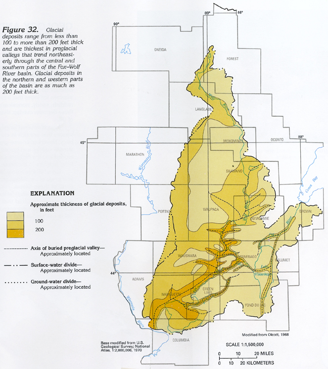 downloadable tiff file J032.tif.gz (3.7MB
compressed)
downloadable tiff file J032.tif.gz (3.7MB
compressed) 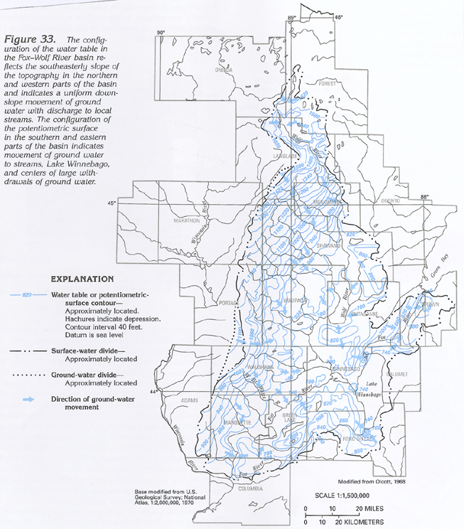 downloadable tiff file J033.tif.gz (3.2MB
compressed)
downloadable tiff file J033.tif.gz (3.2MB
compressed) 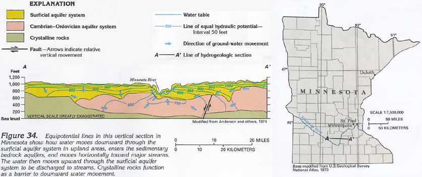 downloadable tiff file J034.tif.gz (2.1MB
compressed)
downloadable tiff file J034.tif.gz (2.1MB
compressed)