GROUND WATER ATLAS of the UNITED STATES
Iowa, Michigan, Minnesota, Wisconsin
HA 730-J
Surficial aquifer system
There are two different files for each illustration
- A 90 ppi JPEG file, suitable for screen viewing is accessed
through the thumbnail image.
- A tiff file is accessed through the "tiff file"
link. All files are Adobe Photoshop. These files have been compressed
with GNU's gzip utility. If your web browser defaults to a screen
display of the file, turn on the "Load to local disk"
option before downloading. Download and process these tiff files
as ascii, not binary.
Ground-water and Surface-water Interaction
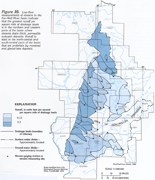
Figure 35 Map showing amount of runoff in the Fox-Wolf River basin
(433K)
 downloadable tiff file J035.tif.gz (3.2MB
compressed)
downloadable tiff file J035.tif.gz (3.2MB
compressed)
Figure 36 Graph showing the similarity of
the chemical composition of water from a well near the West Branch
White River to that of water from the river during low flow (154K)
 downloadable tiff file J036.tif.gz (1.4MB
compressed)
downloadable tiff file J036.tif.gz (1.4MB
compressed)
Figure 37 Map and cross section showing ground-water
movement around Brown's Lake (244K)
 downloadable tiff file J037.tif.gz (2.4MB
compressed)
downloadable tiff file J037.tif.gz (2.4MB
compressed)
 downloadable tiff file J035.tif.gz (3.2MB
compressed)
downloadable tiff file J035.tif.gz (3.2MB
compressed) 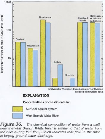 downloadable tiff file J036.tif.gz (1.4MB
compressed)
downloadable tiff file J036.tif.gz (1.4MB
compressed) 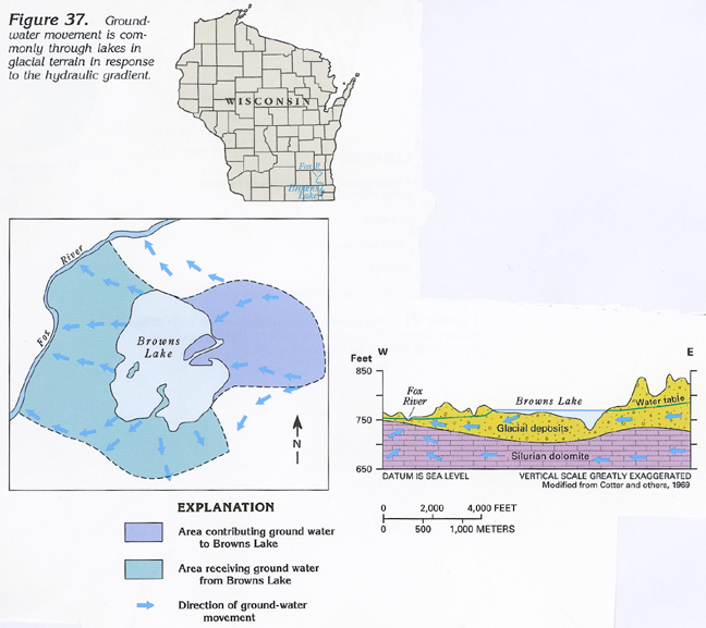 downloadable tiff file J037.tif.gz (2.4MB
compressed)
downloadable tiff file J037.tif.gz (2.4MB
compressed)