GROUND WATER ATLAS of the UNITED STATES
Iowa, Michigan, Minnesota, Wisconsin
HA 730-J
Surficial aquifer system
There are two different files for each illustration
- A 90 ppi JPEG file, suitable for screen viewing is accessed
through the thumbnail image.
- A tiff file is accessed through the "tiff file"
link. All files are Adobe Photoshop. These files have been compressed
with GNU's gzip utility. If your web browser defaults to a screen
display of the file, turn on the "Load to local disk"
option before downloading. Download and process these tiff files
as ascii, not binary.
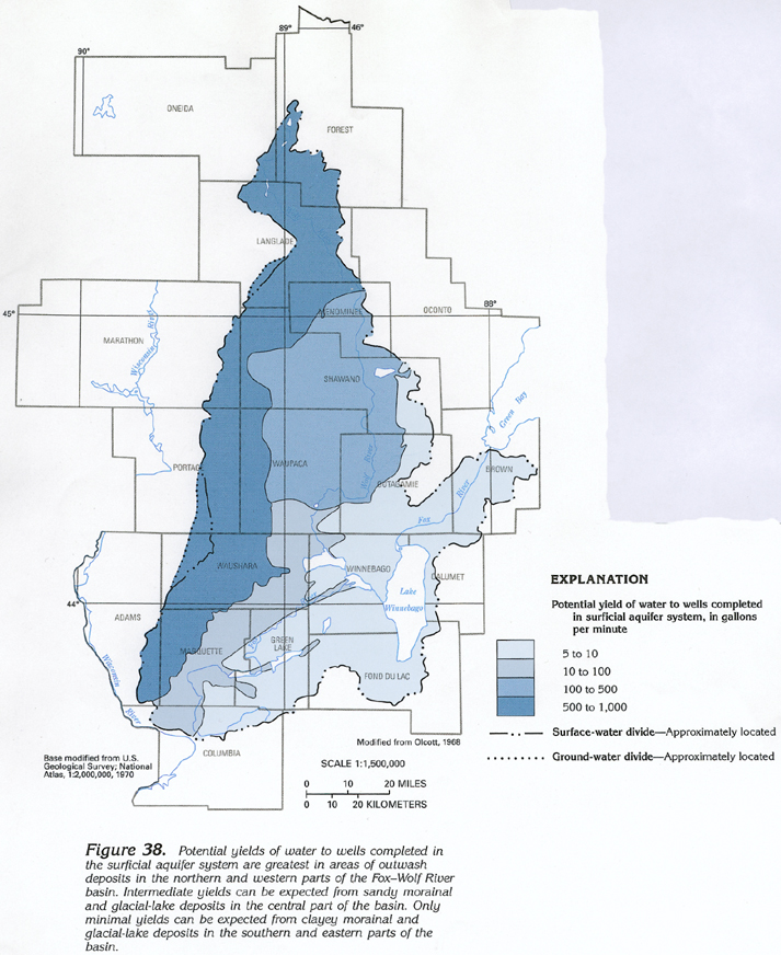
Relation of Potential Well Yields and Water Quality to Type
of Glacial Deposits
Figure 38 Map showing potential yield of wells completed in the
surficial aquifer system (419K)
 downloadable tiff file J038.tif.gz (4.1MB
compressed)
downloadable tiff file J038.tif.gz (4.1MB
compressed)
Figure 39 Map showing dissolved-solids concentrations
in water taken from the surficial aquifer system in the Fox-Wolf
River basin (330K)
 downloadable tiff file J039.tif.gz (3MB
compressed)
downloadable tiff file J039.tif.gz (3MB
compressed)
 downloadable tiff file J038.tif.gz (4.1MB
compressed)
downloadable tiff file J038.tif.gz (4.1MB
compressed) 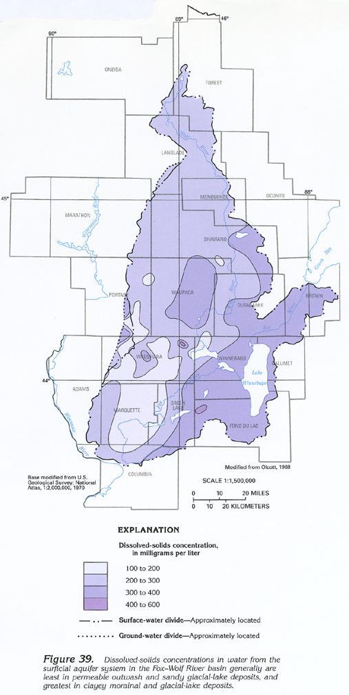 downloadable tiff file J039.tif.gz (3MB
compressed)
downloadable tiff file J039.tif.gz (3MB
compressed)