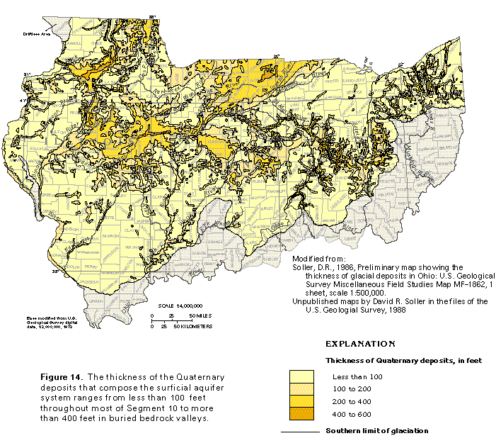
Figure 14 Map showing thickness of Quaternary deposits (66K)
 editable eps file k014.eps.gz
(363K compressed)
editable eps file k014.eps.gz
(363K compressed)
Figure 14 Map showing thickness of Quaternary deposits (66K)
editable eps file k014.eps.gz
(363K compressed)
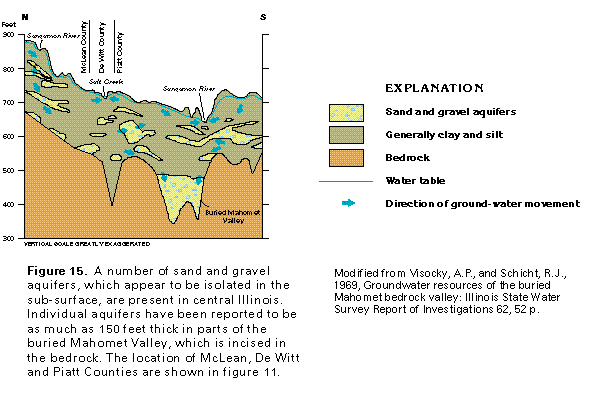
Figure 15 Cross section of central Illinois (17K)
 editable eps file k015.eps.gz
(33K compressed)
editable eps file k015.eps.gz
(33K compressed)
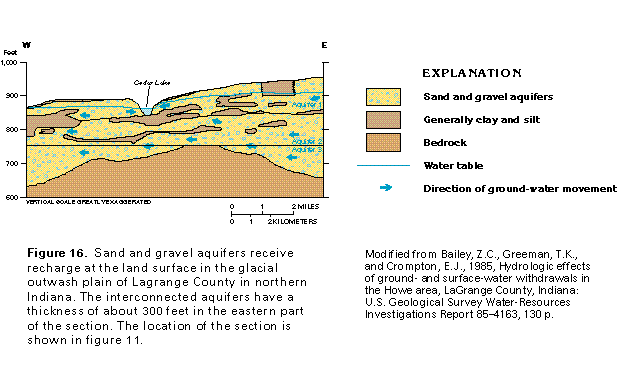
Figure 16 Cross section of Lagrange County in northern Indiana
(17K)
 editable eps file k016.eps.gz
(33K compressed)
editable eps file k016.eps.gz
(33K compressed)
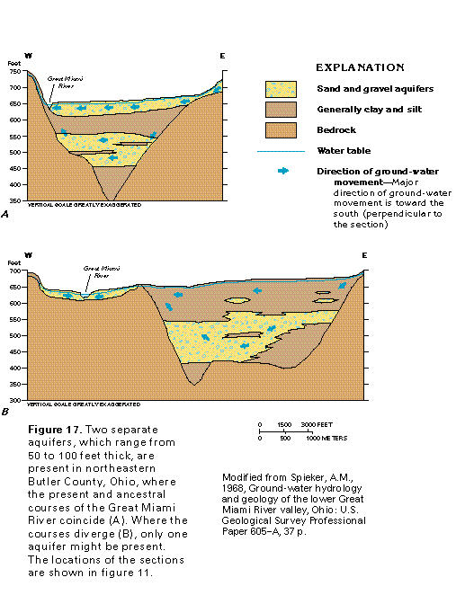
Figure 17 Cross sectionof Butler County Ohio (17K)
 editable eps file k017.eps.gz
(33K compressed)
editable eps file k017.eps.gz
(33K compressed)
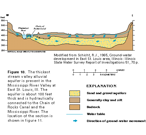
Figure 18 Cross section East of St. Louis Illinois (17K)
 editable eps file k018.eps.gz
(33K compressed)
editable eps file k018.eps.gz
(33K compressed)
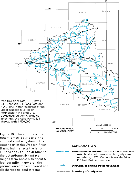
Figure 19 Map showing altitude of potetiometric surface (33K)
 editable eps file k019.eps.gz
(50K compressed)
editable eps file k019.eps.gz
(50K compressed)
Figure 20 Map showing estimated trasmissivity of glacial deposits
(33K)
![]() editable eps file k020.eps.gz
(99K compressed)
editable eps file k020.eps.gz
(99K compressed)
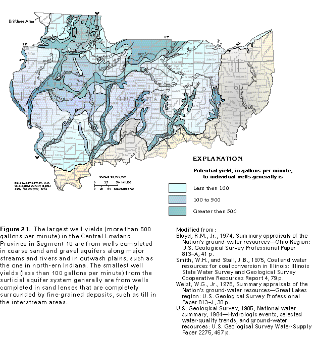
Figure 21 Map showing potential yield to individual wells (50K)
 editable eps file k021.eps.gz
(149K compressed)
editable eps file k021.eps.gz
(149K compressed)
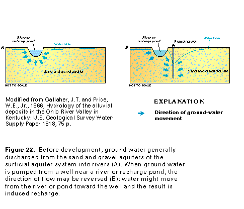
Figure 22 Cross section showing changes in water table due to
pumpage from nearby well (17K)
 editable eps file k022.eps.gz
(33K compressed)
editable eps file k022.eps.gz
(33K compressed)
Figure 23 Water quality chart for Morgan County, Indiana and Dayton
area, Ohio (33K)
![]() editable eps file k023.eps.gz
(33K compressed)
editable eps file k023.eps.gz
(33K compressed)
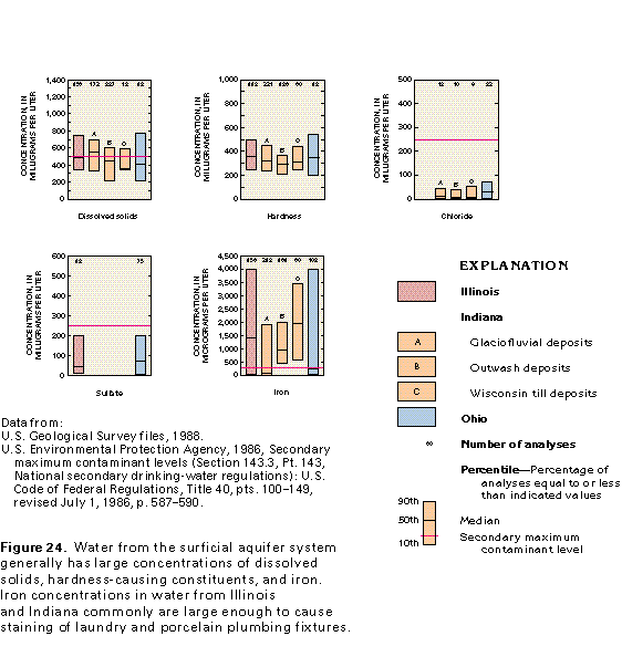
Figure 24 Graph showing concentrations of dissolved solids, hardness-causing
constituents and iron (17K)
 editable eps file k024.eps.gz
(17K compressed)
editable eps file k024.eps.gz
(17K compressed)
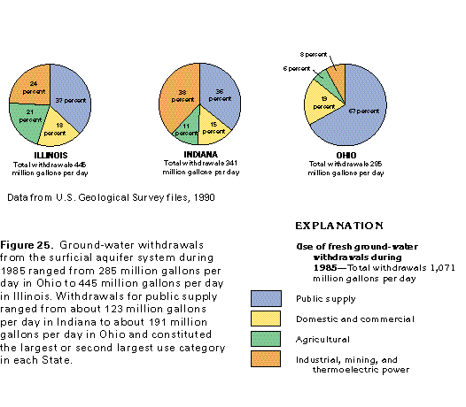
Figure 25 Chart showing use of fresh ground-water withdrawals
during 1985 (17K)
 editable eps file k025.eps.gz
(17K compressed)
editable eps file k025.eps.gz
(17K compressed)