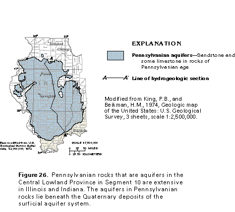
Figure 26 Map of Pennsylvanian aquifers (17K)
 editable eps file k026.eps.gz
(83K compressed)
editable eps file k026.eps.gz
(83K compressed)
Figure 26 Map of Pennsylvanian aquifers (17K)
editable eps file k026.eps.gz
(83K compressed)
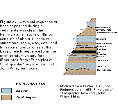
Figure 27 Cross section showing a typical sequence of beds deposited
during a sedimentary cycle (17K)
 editable eps file k027.eps.gz
(50K compressed)
editable eps file k027.eps.gz
(50K compressed)
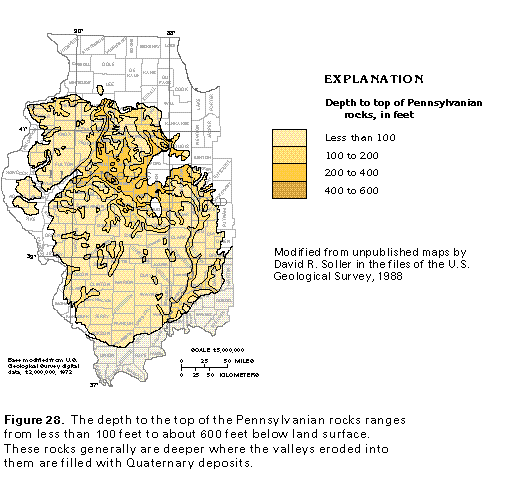
Figure 28 Map showing depth to top of Pennsylvanian rocks (33K)
 editable eps file k028.eps.gz
(149K compressed)
editable eps file k028.eps.gz
(149K compressed)
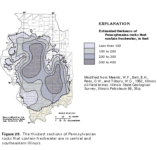
Figure 29 Map showing estimated thickness of Pennsylvanian rocks
that contain freshwater (33K)
 editable eps file k029.eps.gz
(83K compressed)
editable eps file k029.eps.gz
(83K compressed)
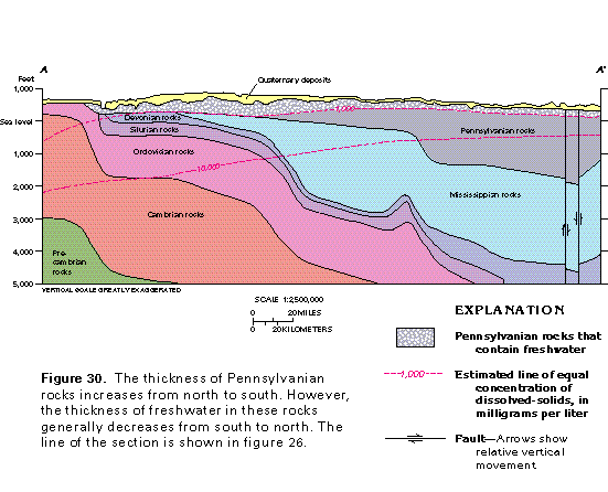
Figure 30 Cross section showing thickness of rocks and the thickness
of freshwater (33K)
 editable eps file k030.eps.gz
(50K compressed)
editable eps file k030.eps.gz
(50K compressed)
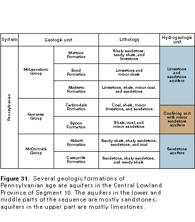
Figure 31 Correlation chart (17K)
 editable eps file k031.eps.gz
(17K compressed)
editable eps file k031.eps.gz
(17K compressed)
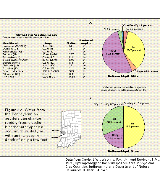
Figure 32 Water quality chart for Clay and Vigo Counties, Indiana
(33K)
 editable eps file k032.eps.gz
(33K compressed)
editable eps file k032.eps.gz
(33K compressed)