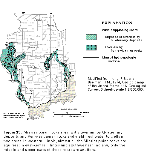
Figure 33 Map showing Mississippian aquifers (33K)
 editable eps file k033.eps.gz
(99K compressed)
editable eps file k033.eps.gz
(99K compressed)
Figure 33 Map showing Mississippian aquifers (33K)
editable eps file k033.eps.gz
(99K compressed)
Figure 34 Correlation chart (17K)
![]() editable eps file k034.eps.gz
(17K compressed)
editable eps file k034.eps.gz
(17K compressed)
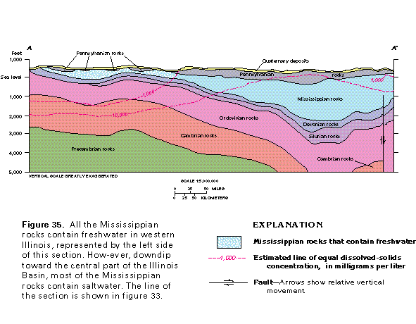
Figure 35 Cross section showing Mississippian rocks that contain
freshwater (17K)
 editable eps file k035.eps.gz
(66K compressed)
editable eps file k035.eps.gz
(66K compressed)
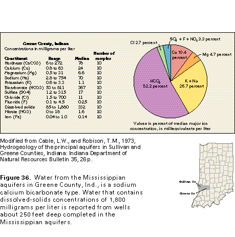
Figure 36 Water quality chart for Greene County, Indiana (17K)
 editable eps file k036.eps.gz
(33K compressed)
editable eps file k036.eps.gz
(33K compressed)
Figure 37 Graph of dissolved-solids concentrations in water from
wells (17K)
![]() editable eps file k037.eps.gz
(17K compressed)
editable eps file k037.eps.gz
(17K compressed)
Figure 38 Graph showing specific capacities of wells completed
in the Keokuk and Burlington Limestones (17K)
![]() editable eps file k038.eps.gz
(17K compressed)
editable eps file k038.eps.gz
(17K compressed)