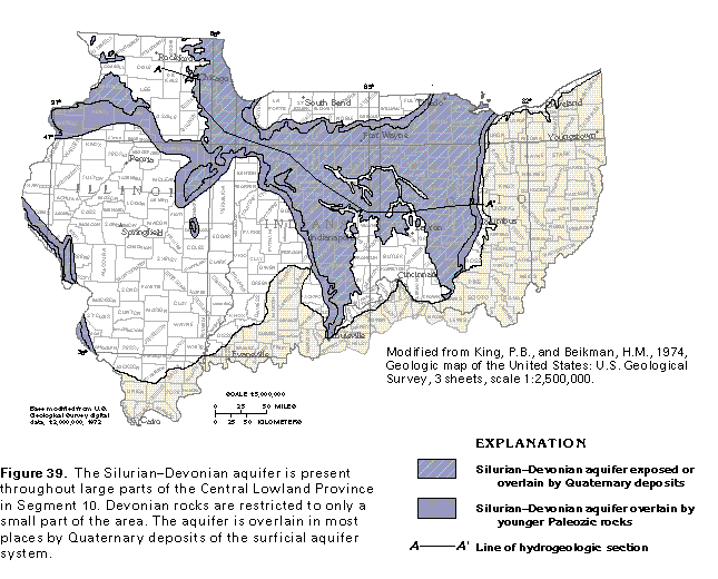
Figure 39 Map showing the Silurian-Devonian aquifer (50K)
 editable eps file k039.eps.gz
(116K compressed)
editable eps file k039.eps.gz
(116K compressed)
Figure 39 Map showing the Silurian-Devonian aquifer (50K)
editable eps file k039.eps.gz
(116K compressed)
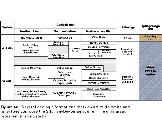
Figure 40 Correlation chart (17K)
 editable eps file k040.eps.gz
(17K compressed)
editable eps file k040.eps.gz
(17K compressed)
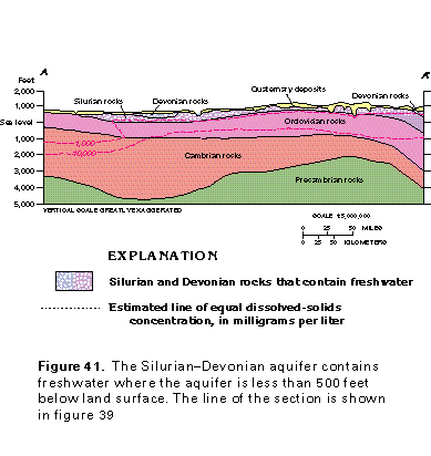
Figure 41 Cross section showing Silurian and Devonian rocks that
contain freshwater (17K)
 editable eps file k041.eps.gz
(50K compressed)
editable eps file k041.eps.gz
(50K compressed)
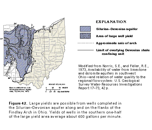
Figure 42 Map showing area of large well yield (33K)
 editable eps file k042.eps.gz
(83K compressed)
editable eps file k042.eps.gz
(83K compressed)
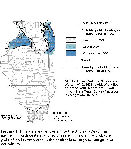
Figure 43 Map showing probable yield of water (17K)
 editable eps file k043.eps.gz
(50K compressed)
editable eps file k043.eps.gz
(50K compressed)
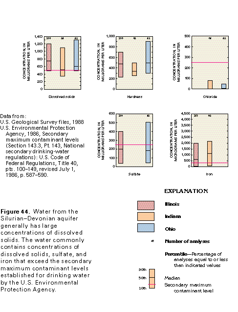
Figure 44 Graph showing concentrations of dissolved solids (17K)
 editable eps file k044.eps.gz
(17K compressed)
editable eps file k044.eps.gz
(17K compressed)
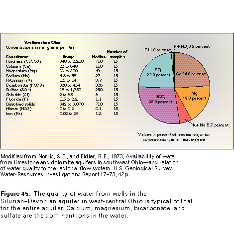
Figure 45 Water quality chart for Southwestern Ohio (17K)
 editable eps file k045.eps.gz
(17K compressed)
editable eps file k045.eps.gz
(17K compressed)
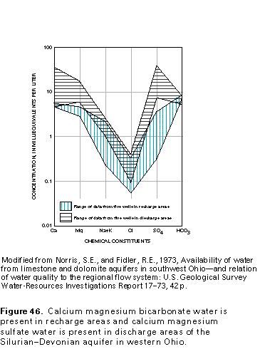
Figure 46 Graph of chemical constituent concentration (17K)
 editable eps file k046.eps.gz
(17K compressed)
editable eps file k046.eps.gz
(17K compressed)
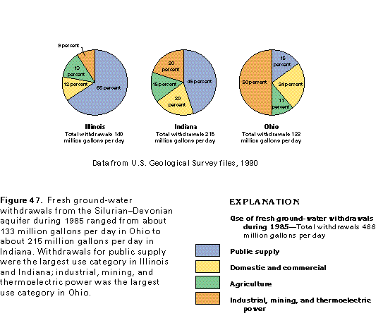
Figure 47 Chart showing use of fresh ground-water withdrawals
during 1985 (17K)
 editable eps file k047.eps.gz
(17K compressed)
editable eps file k047.eps.gz
(17K compressed)