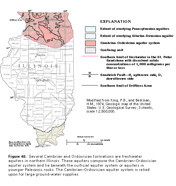
Figure 48 Map showing Cambrian-Ordovician aquifer system (33K)
 editable eps file k048.eps.gz
(149K compressed)
editable eps file k048.eps.gz
(149K compressed)
Figure 48 Map showing Cambrian-Ordovician aquifer system (33K)
editable eps file k048.eps.gz
(149K compressed)
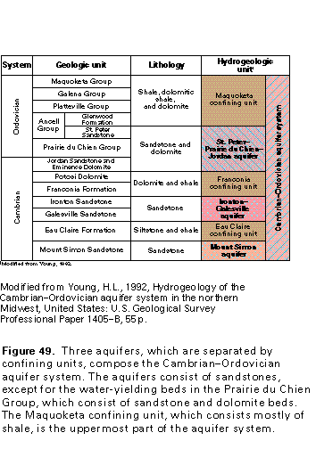
Figure 49 Correlation chart (17K)
 editable eps file k049.eps.gz
(83K compressed)
editable eps file k049.eps.gz
(83K compressed)
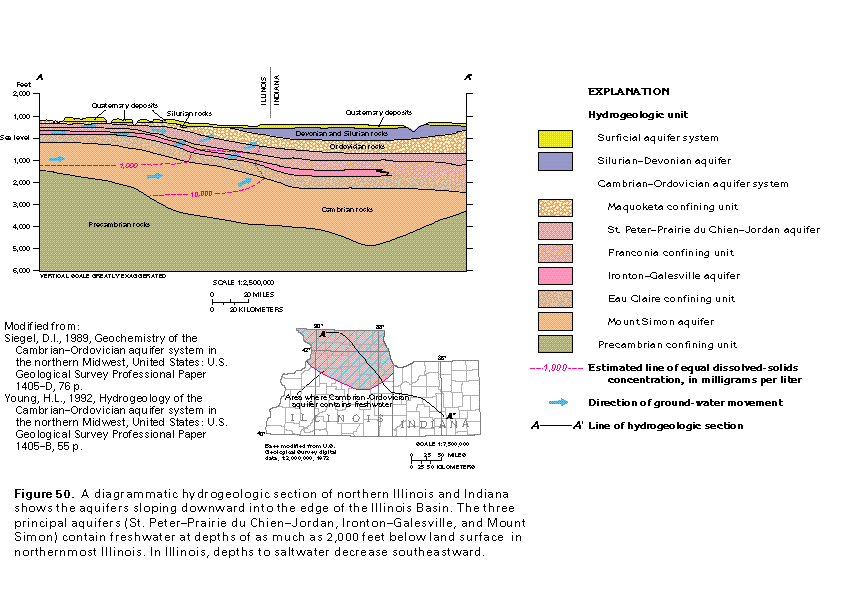
Figure 50 Diagrammatic hydrogeologic section of northern Illinois
and Indiana (33K)
 editable eps file k050.eps.gz
(116K compressed)
editable eps file k050.eps.gz
(116K compressed)
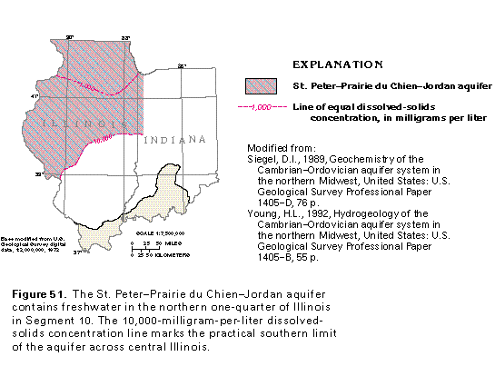
Figure 51 Map showing St. Peter-Prairie du Chien-Jordan
aquifer (17K)
 editable eps file k051.eps.gz
(50K compressed)
editable eps file k051.eps.gz
(50K compressed)
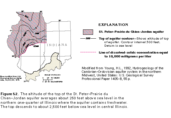
Figure 52 Map showing the altitude of the St. Peter-Prairie
du Chien-Jordan aquifer (17K)
 editable eps file k052.eps.gz
(66K compressed)
editable eps file k052.eps.gz
(66K compressed)
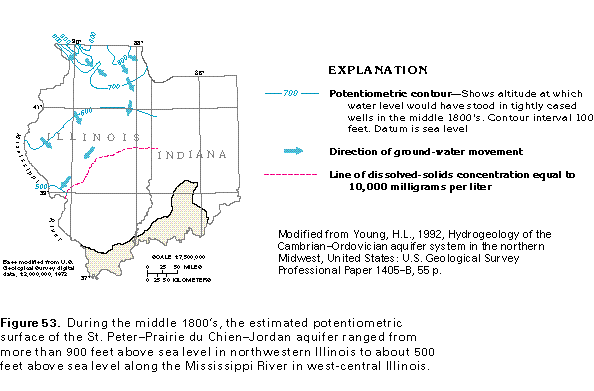
Figure 53 Potentiometric surface map of the St. Peter-Prairie
du Chien-Jordan aquifer (17K)
 editable eps file k053.eps.gz
(33K compressed)
editable eps file k053.eps.gz
(33K compressed)
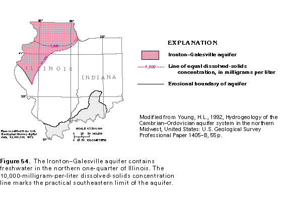
Figure 54 Map showing the Inonton-Galesville aquifer (17K)
 editable eps file k054.eps.gz
(66K compressed)
editable eps file k054.eps.gz
(66K compressed)
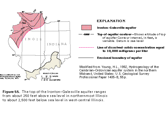
Figure 55 Map showing the altitude of the Inonton-Galesville
aquifer (17K)
 editable eps file k055.eps.gz
(66K compressed)
editable eps file k055.eps.gz
(66K compressed)
Figure 56 Potentiometric surface map of the Inonton-Galesville
aquifer (17K)
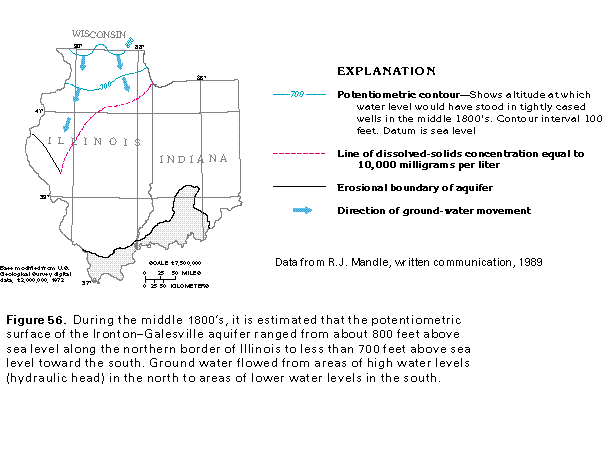 editable eps file k056.eps.gz
(33K compressed)
editable eps file k056.eps.gz
(33K compressed)
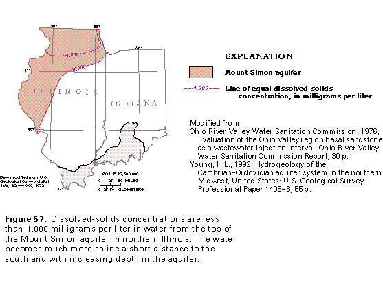
Figure 57 Map showing the Mount Simon aquifer (17K)
 editable eps file k057.eps.gz
(66K compressed)
editable eps file k057.eps.gz
(66K compressed)
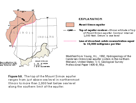
Figure 58 Map showing the altitude of the Mount Simon aquifer
(17K)
 editable eps file k058.eps.gz
(66K compressed)
editable eps file k058.eps.gz
(66K compressed)
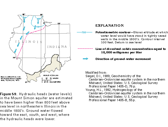
Figure 59 Potentiometric surface map of the Mount Simon aquifer
(17K)
 editable eps file k059.eps.gz
(50K compressed)
editable eps file k059.eps.gz
(50K compressed)
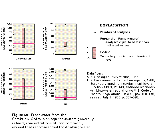
Figure 60 Graph showing concentrations of dissolved solids (17K)
 editable eps file k060.eps.gz
(17K compressed)
editable eps file k060.eps.gz
(17K compressed)
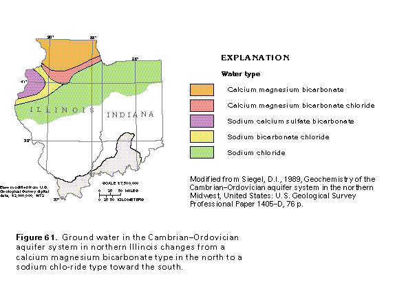
Figure 61 Map showing water type (17K)
 editable eps file k061.eps.gz
(33K compressed)
editable eps file k061.eps.gz
(33K compressed)
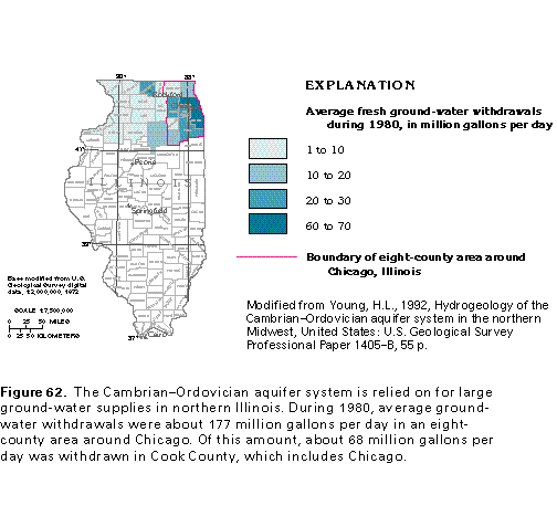
Figure 62 Map showing average fresh ground-water withdrawals during
1980 (17K)
 editable eps file k062.eps.gz
(33K compressed)
editable eps file k062.eps.gz
(33K compressed)
Figure 63 Graph of Average withdrawals from the Cambrian-Ordovician
aquifer system (17K)
![]() editable eps file k063.eps.gz
(17K compressed)
editable eps file k063.eps.gz
(17K compressed)
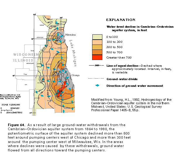
Figure 64 Map of water level decline in the Cambrian-Ordovician
aquifer system (33K)
 editable eps file k064.eps.gz
(66K compressed)
editable eps file k064.eps.gz
(66K compressed)
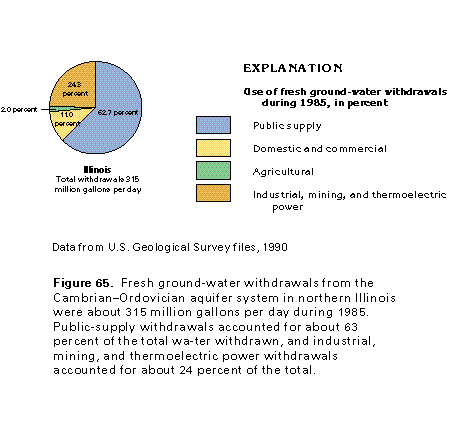
Figure 65 Chart showing the use of fresh ground-water withdrawals
during 1985 (17K)
 editable eps file k065.eps.gz
(17K compressed)
editable eps file k065.eps.gz
(17K compressed)