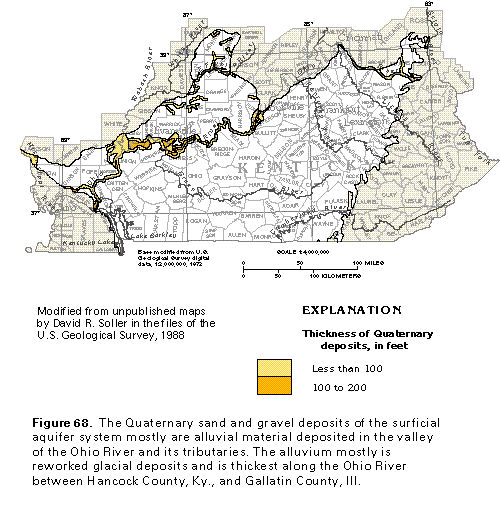
Figure 68 Map showing thickness of Quaternary deposits (33K)
 editable eps file k068.eps.gz
(149K compressed)
editable eps file k068.eps.gz
(149K compressed)
Figure 68 Map showing thickness of Quaternary deposits (33K)
editable eps file k068.eps.gz
(149K compressed)
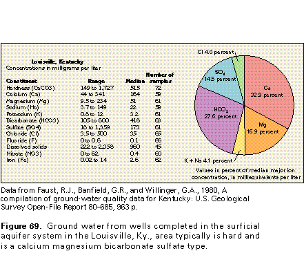
Figure 69 Water quality chart for Louisville, Kentucky (17K)
 editable eps file k069.eps.gz
(17K compressed)
editable eps file k069.eps.gz
(17K compressed)
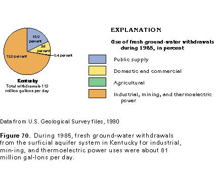
Figure 70 Chart showing use of fresh ground-water withdrawals
during 1985 (17K)
 editable eps file k070.eps.gz
(17K compressed)
editable eps file k070.eps.gz
(17K compressed)
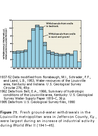
Figure 71 Graph of withdrawals from wells in the Louisville metropolitan
area (17K)
 editable eps file k071.eps.gz
(17K compressed)
editable eps file k071.eps.gz
(17K compressed)
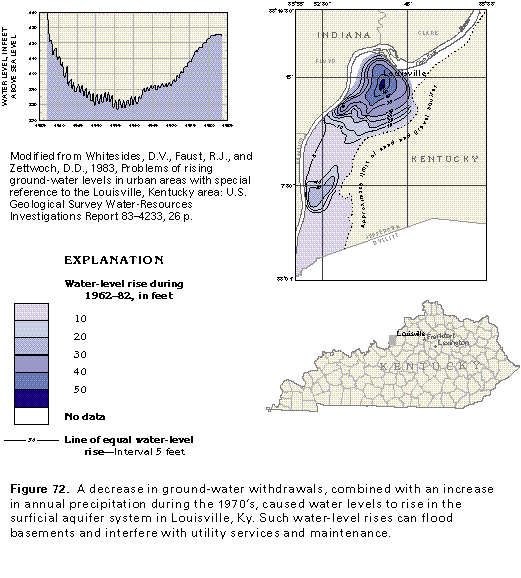
Figure 72 Graph and map showing water-level rise during 1962-82
(33K)
 editable eps file k072.eps.gz
(83K compressed)
editable eps file k072.eps.gz
(83K compressed)