GROUND WATER ATLAS of the UNITED STATES
Delaware, Maryland, New Jersey, North Carolina, Pennsylvania, Virginia,
West Virginia
HA 730-L
North Atlantic Coastal Plain aquifer system
There are two different files for each illustration
- A 72 ppi GIF file, suitable for screen viewing is accessed through
the thumbnail image
- An eps file, suitable for downloading to be printed or edited is accessed
through the "eps file" link. Most files are Adobe Illustrator
6.0, exceptions are noted. These files have been compressed with GNU's
gzip utility. If your web browser defaults to a screen display of the file,
turn on the "Load to local disk" option before downloading. Download
and process these eps files as ascii, not binary.
Castle HayneAquia aquifer
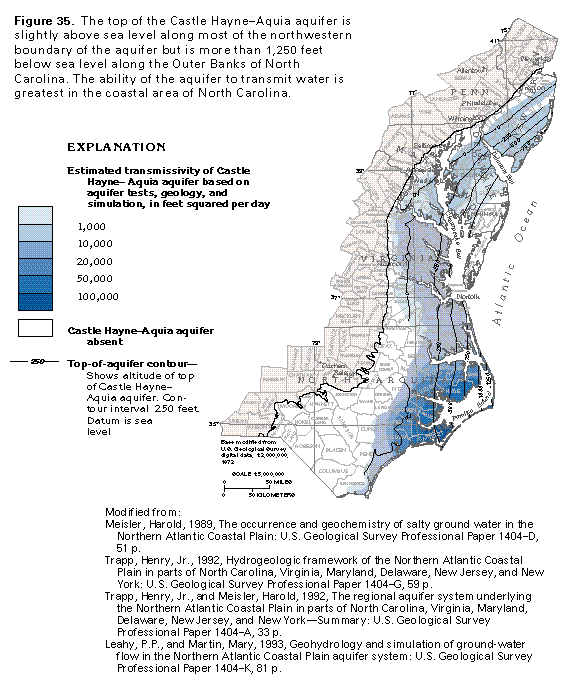
Figure 35 Map showing estimated transmissivity (50K)
 editable eps file L035.eps.gz
(198K compressed)
editable eps file L035.eps.gz
(198K compressed)
Figure 36 Photo of Glauconitic sand (17K)
 This illustration contains a placed image. Download the Adobe Illustrator
6 eps file L036.eps.gz (1.7M compressed)
which contains an imbedded Adobe Photoshop 3 (eps) file. You may also want
to download the editable Photoshop
file L036psh.eps.gz (1.6M compressed)
This illustration contains a placed image. Download the Adobe Illustrator
6 eps file L036.eps.gz (1.7M compressed)
which contains an imbedded Adobe Photoshop 3 (eps) file. You may also want
to download the editable Photoshop
file L036psh.eps.gz (1.6M compressed)
Figure 37 Map showing potentiometric contours (33K)
 editable eps file L037.eps.gz
(165K compressed)
editable eps file L037.eps.gz
(165K compressed)
Figure 38 Map showing potentiometric contours
(33K)
 editable eps file L038.eps.gz
(182K compressed)
editable eps file L038.eps.gz
(182K compressed)
Figure 39 Map showing hydrochemical facies (33K)
 editable eps file L039.eps.gz
(198K compressed)
editable eps file L039.eps.gz
(198K compressed)
Figure 40 Map showing fresh gound-water withdrawals
during 197980 (33K)
 editable eps file L040.eps.gz
(215K compressed)
editable eps file L040.eps.gz
(215K compressed)
Figure 41 Chart showing the use of fresh ground-water
withdrawals during 1985 (17K)
 editable eps file L041.eps.gz
(17K compressed)
editable eps file L041.eps.gz
(17K compressed)
 editable eps file L035.eps.gz
(198K compressed)
editable eps file L035.eps.gz
(198K compressed) 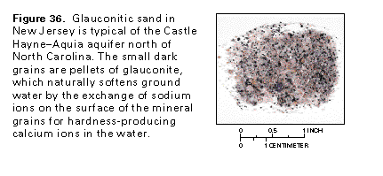 This illustration contains a placed image. Download the Adobe Illustrator
6 eps file L036.eps.gz (1.7M compressed)
which contains an imbedded Adobe Photoshop 3 (eps) file. You may also want
to download the editable Photoshop
file L036psh.eps.gz (1.6M compressed)
This illustration contains a placed image. Download the Adobe Illustrator
6 eps file L036.eps.gz (1.7M compressed)
which contains an imbedded Adobe Photoshop 3 (eps) file. You may also want
to download the editable Photoshop
file L036psh.eps.gz (1.6M compressed) 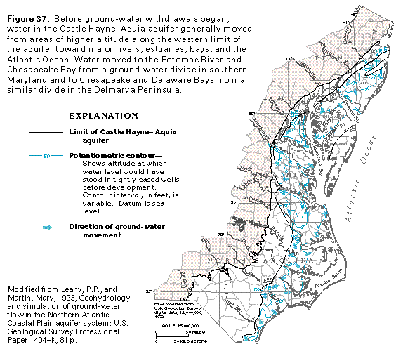 editable eps file L037.eps.gz
(165K compressed)
editable eps file L037.eps.gz
(165K compressed) 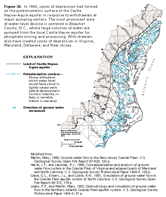 editable eps file L038.eps.gz
(182K compressed)
editable eps file L038.eps.gz
(182K compressed) 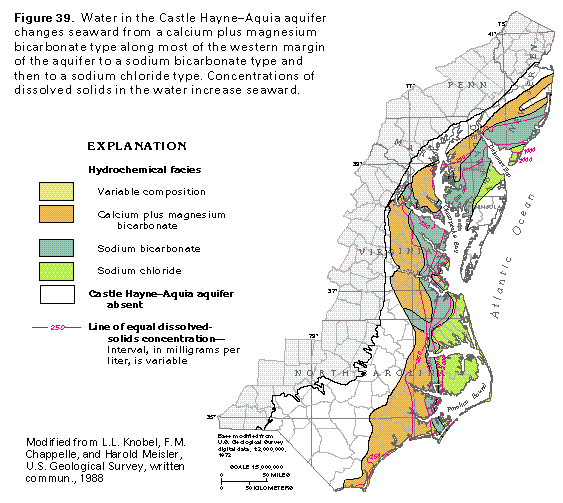 editable eps file L039.eps.gz
(198K compressed)
editable eps file L039.eps.gz
(198K compressed) 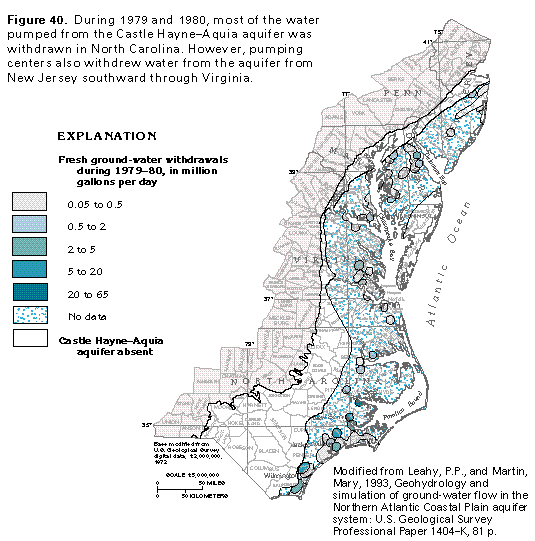 editable eps file L040.eps.gz
(215K compressed)
editable eps file L040.eps.gz
(215K compressed) 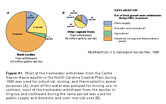 editable eps file L041.eps.gz
(17K compressed)
editable eps file L041.eps.gz
(17K compressed)