GROUND WATER ATLAS of the UNITED STATES
Delaware, Maryland, New Jersey, North Carolina, Pennsylvania, Virginia,
West Virginia
HA 730-L
Regional summary
There are two different files for each illustration
- A 72 ppi GIF file, suitable for screen viewing is accessed through
the thumbnail image
- An eps file, suitable for downloading to be printed or edited is accessed
through the "eps file" link. Most files are Adobe Illustrator
6.0, exceptions are noted. These files have been compressed with GNU's
gzip utility. If your web browser defaults to a screen display of the file,
turn on the "Load to local disk" option before downloading. Download
and process these eps files as ascii, not binary.
Geology
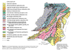
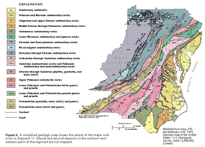
Figure 8 Geology map (83K)
 editable eps file L008.eps.gz
(611K compressed)
editable eps file L008.eps.gz
(611K compressed)
Figure 9 Geologic diagramatic section (33K)
 This illustration contains a placed image. Download the Adobe Illustrator
6 eps file L009.eps.gz (314K compressed)
which contains an imbedded Adobe Photoshop 3 (eps) file. You may also want
to download the editable Photoshop
file L009psh.eps.gz (264K compressed)
This illustration contains a placed image. Download the Adobe Illustrator
6 eps file L009.eps.gz (314K compressed)
which contains an imbedded Adobe Photoshop 3 (eps) file. You may also want
to download the editable Photoshop
file L009psh.eps.gz (264K compressed)
 editable eps file L008.eps.gz
(611K compressed)
editable eps file L008.eps.gz
(611K compressed) 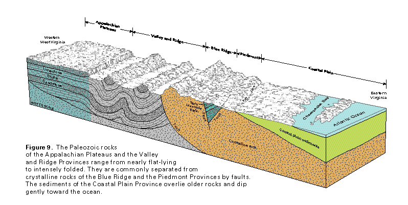 This illustration contains a placed image. Download the Adobe Illustrator
6 eps file L009.eps.gz (314K compressed)
which contains an imbedded Adobe Photoshop 3 (eps) file. You may also want
to download the editable Photoshop
file L009psh.eps.gz (264K compressed)
This illustration contains a placed image. Download the Adobe Illustrator
6 eps file L009.eps.gz (314K compressed)
which contains an imbedded Adobe Photoshop 3 (eps) file. You may also want
to download the editable Photoshop
file L009psh.eps.gz (264K compressed)