GROUND WATER ATLAS of the UNITED STATES
Connecticut, Maine, Massachusetts, New Hampshire, New York, Rhode Island,
Vermont
HA 730-M
Surficial and Northern Atlantic Coastal Plain aquifer systems, Long Island
There are two different files for each illustration
- A 72 ppi GIF file, suitable for screen viewing is accessed through
the thumbnail image
- An eps file, suitable for downloading to be printed or edited is accessed
through the "eps file" link. Most files are Adobe Illustrator
6.0, exceptions are noted. These files have been compressed with GNU's
gzip utility. If your web browser defaults to a screen display of the file,
turn on the "Load to local disk" option before downloading. Download
and process these eps files as ascii, not binary.
Introduction
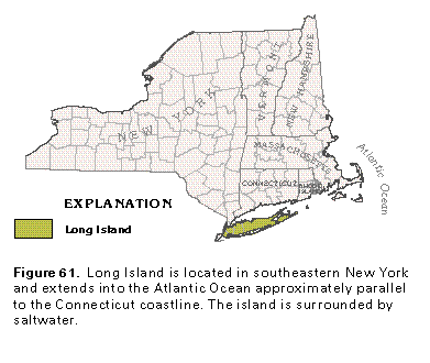
Figure 61 Map showing location Long Island (17K)
 editable eps file M061.eps.gz
(99K compressed)
editable eps file M061.eps.gz
(99K compressed)
Figure 62 Map showing altitiude of land surface on Long Island
(33K)
 editable eps file M062.eps.gz
(215K compressed)
editable eps file M062.eps.gz
(215K compressed)
Figure 63 Hydrogeologic cross section (17K)
 editable eps file M063.eps.gz
(66K compressed)
editable eps file M063.eps.gz
(66K compressed)
 editable eps file M061.eps.gz
(99K compressed)
editable eps file M061.eps.gz
(99K compressed) 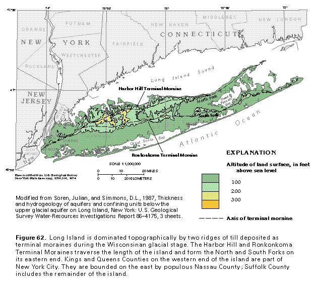 editable eps file M062.eps.gz
(215K compressed)
editable eps file M062.eps.gz
(215K compressed) 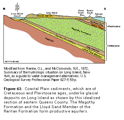 editable eps file M063.eps.gz
(66K compressed)
editable eps file M063.eps.gz
(66K compressed)