GROUND WATER ATLAS of the UNITED STATES
Connecticut, Maine, Massachusetts, New Hampshire, New York, Rhode Island,
Vermont
HA 730-M
Surficial aquifer system, Valley-fill glacial aquifers
There are two different files for each illustration
- A 72 ppi GIF file, suitable for screen viewing is accessed through
the thumbnail image
- An eps file, suitable for downloading to be printed or edited is accessed
through the "eps file" link. Most files are Adobe Illustrator
6.0, exceptions are noted. These files have been compressed with GNU's
gzip utility. If your web browser defaults to a screen display of the file,
turn on the "Load to local disk" option before downloading. Download
and process these eps files as ascii, not binary.
Geology
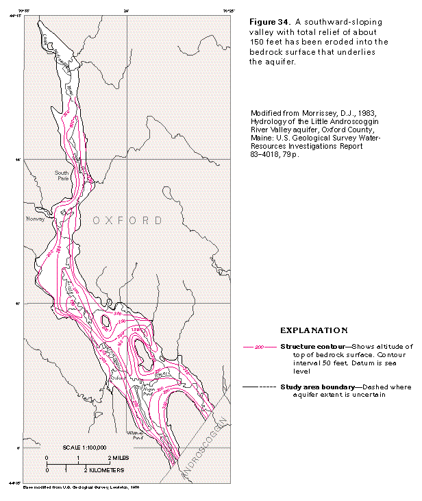
Figure 34 Map showing structure contours (33K)
 editable eps file M034.eps.gz
(83K compressed)
editable eps file M034.eps.gz
(83K compressed)
Figure 35 Map showing surficial materials (50K)
 editable eps file M035.eps.gz
(116K compressed)
editable eps file M035.eps.gz
(116K compressed)
Figure 36 Cross section of aquifer (33K)
 editable eps file M036.eps.gz
(83K compressed)
editable eps file M036.eps.gz
(83K compressed)
Figure 37 Map showing saturated thickness (50K)
 editable eps file M037.eps.gz
(99K compressed)
editable eps file M037.eps.gz
(99K compressed)
 editable eps file M034.eps.gz
(83K compressed)
editable eps file M034.eps.gz
(83K compressed) 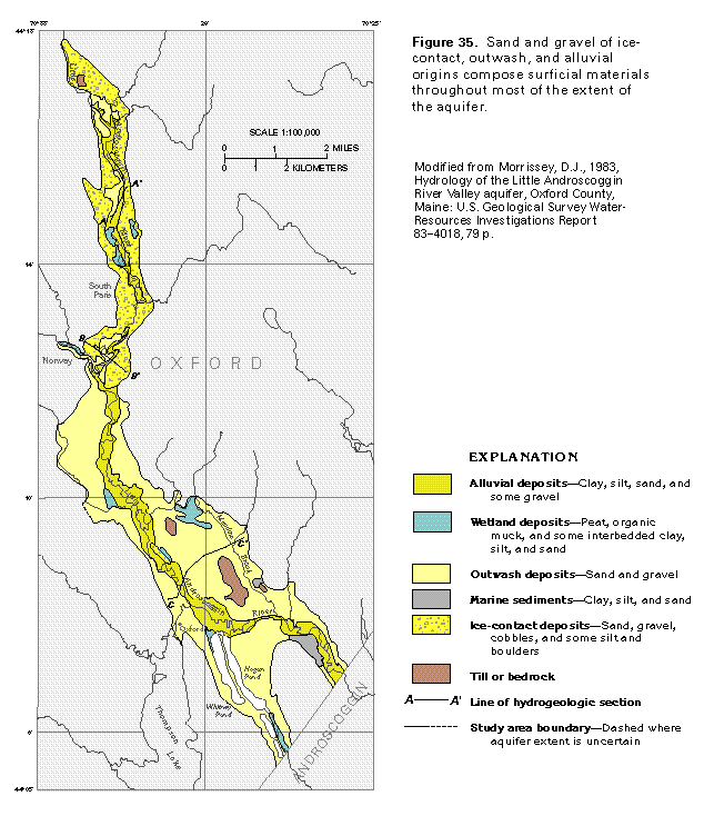 editable eps file M035.eps.gz
(116K compressed)
editable eps file M035.eps.gz
(116K compressed) 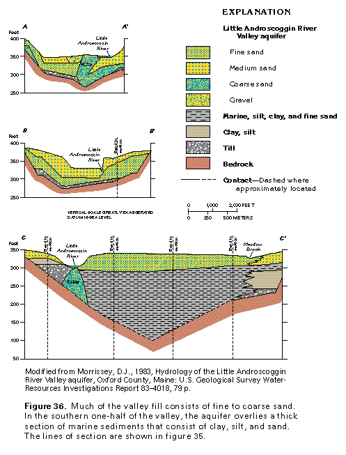 editable eps file M036.eps.gz
(83K compressed)
editable eps file M036.eps.gz
(83K compressed) 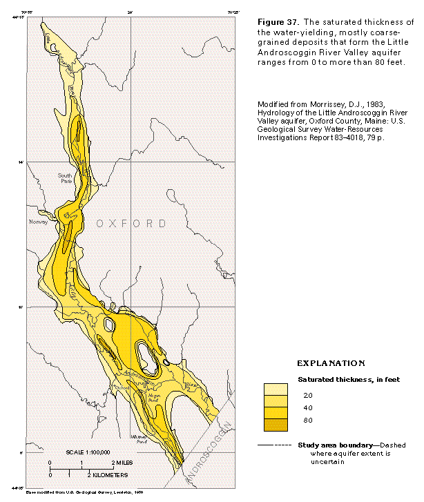 editable eps file M037.eps.gz
(99K compressed)
editable eps file M037.eps.gz
(99K compressed)