GROUND WATER ATLAS of the UNITED STATES
Alaska, Hawaii, Puerto Rico and the U. S. Virgin Islands
HA 730-N
Alaska Regional summary
There are two different files for each illustration
- A 72 ppi GIF file, suitable for screen viewing is accessed
through the thumbnail image.
- An eps file, suitable for downloading to be printed or edited
is accessed through the "eps file" link. Most files
are Adobe Illustrator 6.0, exceptions are noted. These files
have been compressed with GNU's gzip utility. If your web browser
defaults to a screen display of the file, turn on the "Load
to local disk" option before downloading. Download and process
these eps files as ascii, not binary.
Permafrost
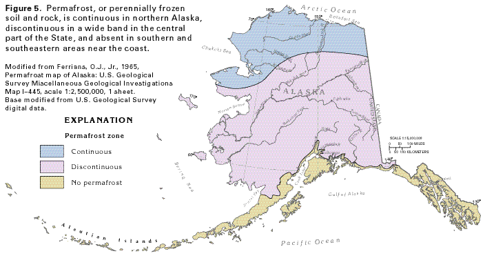
Figure 5 Map showing permafrost zones in Alaska (25K)
 editable eps file N005.eps.gz
(200K compressed)
editable eps file N005.eps.gz
(200K compressed)
Figure 6 Diagrammatic section showing the
approximate depth of the permafrost (29K)
 editable eps file N006.eps.gz
(177K compressed)
editable eps file N006.eps.gz
(177K compressed)
Figure 7 Photograph showing the small "thaw
lakes" that form in the continuous permafrost areas (31K)
 editable eps file N007.eps.gz
(5.3M compressed)
editable eps file N007.eps.gz
(5.3M compressed)
Figure 8 Photograph showing the pingos that form
in the permafrost areas (25K)
 editable eps file N008.eps.gz
(4.2M compressed)
editable eps file N008.eps.gz
(4.2M compressed)
 editable eps file N005.eps.gz
(200K compressed)
editable eps file N005.eps.gz
(200K compressed) 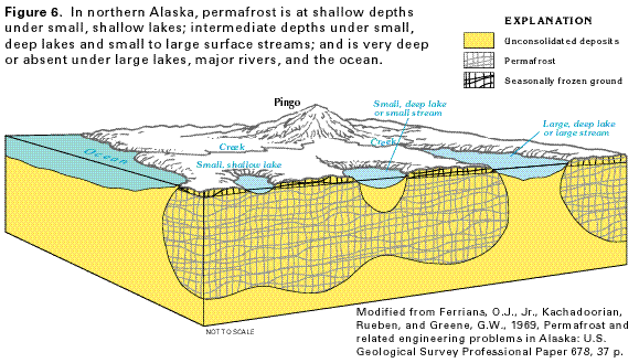 editable eps file N006.eps.gz
(177K compressed)
editable eps file N006.eps.gz
(177K compressed) 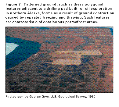 editable eps file N007.eps.gz
(5.3M compressed)
editable eps file N007.eps.gz
(5.3M compressed) 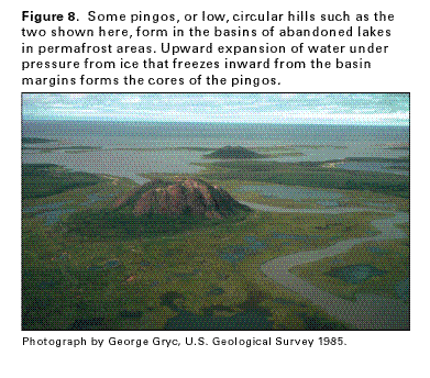 editable eps file N008.eps.gz
(4.2M compressed)
editable eps file N008.eps.gz
(4.2M compressed)