GROUND WATER ATLAS of the UNITED STATES
Alaska, Hawaii, Puerto Rico and the U. S. Virgin Islands
HA 730-N
Alaska Unconsolidated-deposit aquifers
There are two different files for each illustration
- A 72 ppi GIF file, suitable for screen viewing is accessed
through the thumbnail image.
- An eps file, suitable for downloading to be printed or edited
is accessed through the "eps file" link. Most files
are Adobe Illustrator 6.0, exceptions are noted. These files
have been compressed with GNU's gzip utility. If your web browser
defaults to a screen display of the file, turn on the "Load
to local disk" option before downloading. Download and process
these eps files as ascii, not binary.
Cook Inlet Aquifer System
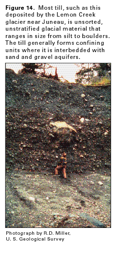
Figure 14 Photograph showing unsorted, unstratified
glacial till deposited by the Lemon Creek glacier near Juneau,
Alaska (37K)
 editable eps file N014.eps.gz
(5.1M compressed)
editable eps file N014.eps.gz
(5.1M compressed)
Figure 15 Hydrogeologic sections of three
areas in the Cook Inlet aquifer system (58K)
 editable eps file N015.eps.gz
(130K compressed)
editable eps file N015.eps.gz
(130K compressed)
Figure 16 Diagrammatic section showing ground
water movement in the unconsolidated-deposit aquifers of the Cook
Inlet aquifer system (52K)
 editable eps file N016.eps.gz
(371K compressed)
editable eps file N016.eps.gz
(371K compressed)
Figure 17 Map showing potentiometric contours
and movement of water in the unconfined aquifer near Anchorage,
Alaska (27K)
 editable eps file N017.eps.gz
(73K compressed)
editable eps file N017.eps.gz
(73K compressed)
Figure 18 Map showing potentiometric contours
and movement of water in the confined aquifer near Anchorage,
Alaska before the aquifer was intensively developed (26K)
 editable eps file N018.eps.gz
(64K compressed)
editable eps file N018.eps.gz
(64K compressed)
Figure 19 Map showing potentiometric contours
and movement of water in the confined aquifer near Anchorage,
Alaska after the aquifer was intensively developed (26K)
 editable eps file N019.eps.gz
(67K compressed)
editable eps file N019.eps.gz
(67K compressed)
Figure 20 Map showing net water-level decline
in confined aquifer near Anchorage, Alaska between 1955 and 1969
(27K)
 editable eps file N020.eps.gz
(68K compressed)
editable eps file N020.eps.gz
(68K compressed)
 editable eps file N014.eps.gz
(5.1M compressed)
editable eps file N014.eps.gz
(5.1M compressed) 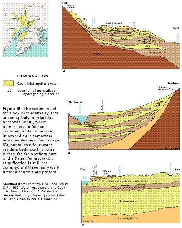 editable eps file N015.eps.gz
(130K compressed)
editable eps file N015.eps.gz
(130K compressed) 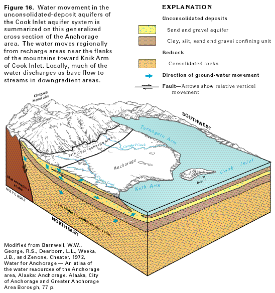 editable eps file N016.eps.gz
(371K compressed)
editable eps file N016.eps.gz
(371K compressed) 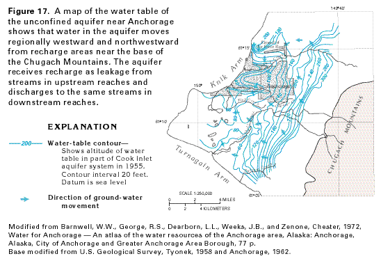 editable eps file N017.eps.gz
(73K compressed)
editable eps file N017.eps.gz
(73K compressed) 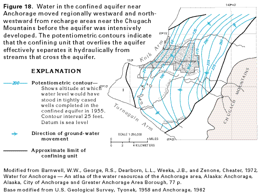 editable eps file N018.eps.gz
(64K compressed)
editable eps file N018.eps.gz
(64K compressed) 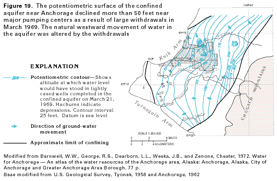 editable eps file N019.eps.gz
(67K compressed)
editable eps file N019.eps.gz
(67K compressed) 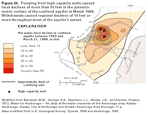 editable eps file N020.eps.gz
(68K compressed)
editable eps file N020.eps.gz
(68K compressed)