GROUND WATER ATLAS of the UNITED STATES
Alaska, Hawaii, Puerto Rico and the U. S. Virgin Islands
HA 730-N
Puerto Rico and the U. S. Virgin Islands Kingshill aquifer
There are two different files for each illustration
- A 72 ppi GIF file, suitable for screen viewing is accessed
through the thumbnail image.
- An eps file, suitable for downloading to be printed or edited
is accessed through the "eps file" link. Most files
are Adobe Illustrator 6.0, exceptions are noted. These files
have been compressed with GNU's gzip utility. If your web browser
defaults to a screen display of the file, turn on the "Load
to local disk" option before downloading. Download and process
these eps files as ascii, not binary.
Aquifers and Confining Units
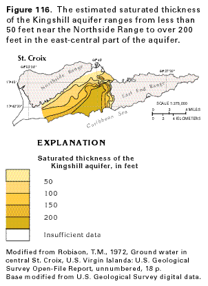
Figure 116 Map showing the estimated saturated thickness
of the Kingshill aquifer (14K)
 editable eps file N116.eps.gz
(31K compressed)
editable eps file N116.eps.gz
(31K compressed)
Figure 117 Map showing the probable yield
of water to wells in the alluvial and Kingshill aquifers (18K)
 editable eps file N117.eps.gz
(52K compressed)
editable eps file N117.eps.gz
(52K compressed)
 editable eps file N116.eps.gz
(31K compressed)
editable eps file N116.eps.gz
(31K compressed) 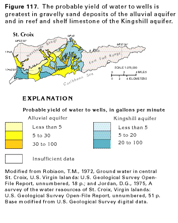 editable eps file N117.eps.gz
(52K compressed)
editable eps file N117.eps.gz
(52K compressed)