GROUND WATER ATLAS of the UNITED STATES
Alaska, Hawaii, Puerto Rico and the U. S. Virgin Islands
HA 730-N
Puerto Rico and the U. S. Virgin Islands North Coast Limestone
aquifer system
There are two different files for each illustration
- A 72 ppi GIF file, suitable for screen viewing is accessed
through the thumbnail image.
- An eps file, suitable for downloading to be printed or edited
is accessed through the "eps file" link. Most files
are Adobe Illustrator 6.0, exceptions are noted. These files
have been compressed with GNU's gzip utility. If your web browser
defaults to a screen display of the file, turn on the "Load
to local disk" option before downloading. Download and process
these eps files as ascii, not binary.
Ground-Water Flow
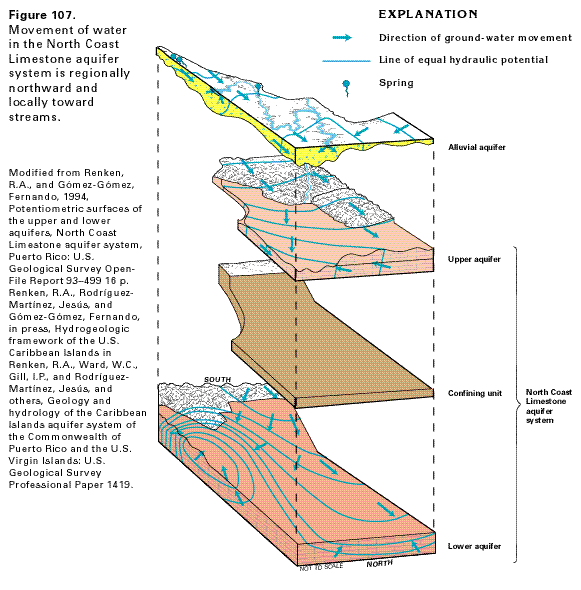
Figure 107 Exploded diagrammatic section showing the
movement of ground-water through the North Coast Limestone aquifer
system (38K)
 editable eps file N107.eps.gz
(394K compressed)
editable eps file N107.eps.gz
(394K compressed)
Figure 108 Map showing the altitude of the
water table in the upper aquifer of the North Coast Limestone
aquifer system (40K)
 editable eps file N108.eps.gz
(176K compressed)
editable eps file N108.eps.gz
(176K compressed)
Figure 109 Map showing the altitude of the
water table in the lower aquifer of the North Coast Limestone
aquifer system before and after development (65K)
 editable eps file N109.eps.gz
(376K compressed)
editable eps file N109.eps.gz
(376K compressed)
Figure 110 Map showing the water-level decline
in the lower aquifer of the North Coast Limestone aquifer system
during 1968-1987 (30K)
 editable eps file N110.eps.gz
(162K compressed)
editable eps file N110.eps.gz
(162K compressed)
 editable eps file N107.eps.gz
(394K compressed)
editable eps file N107.eps.gz
(394K compressed) 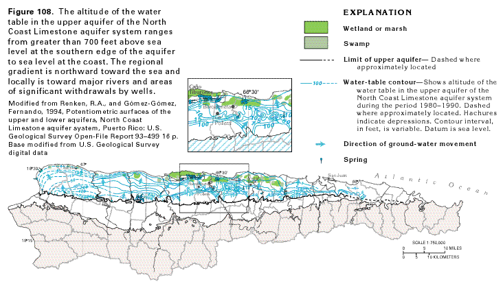 editable eps file N108.eps.gz
(176K compressed)
editable eps file N108.eps.gz
(176K compressed) 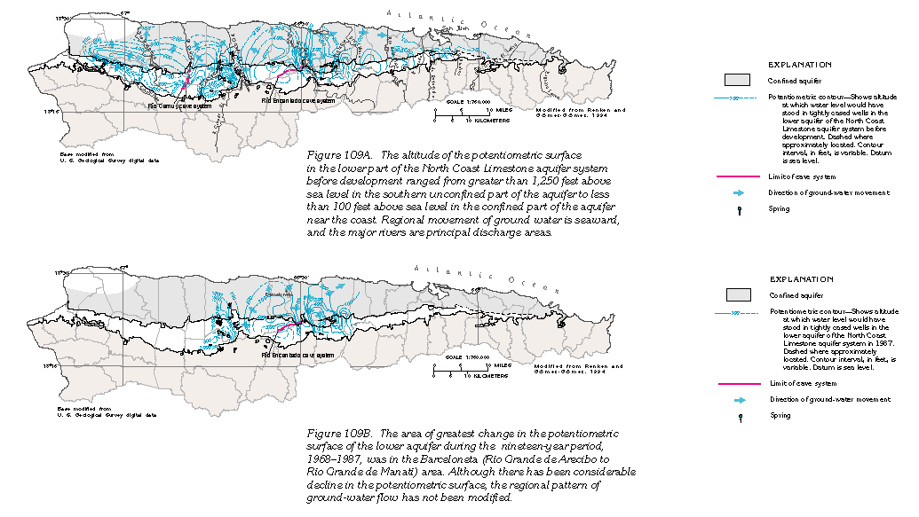 editable eps file N109.eps.gz
(376K compressed)
editable eps file N109.eps.gz
(376K compressed) 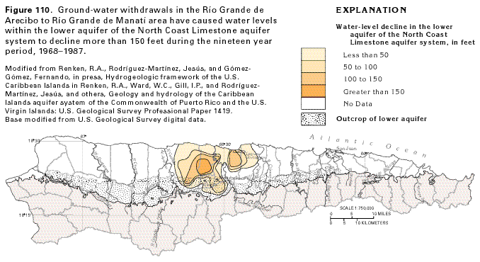 editable eps file N110.eps.gz
(162K compressed)
editable eps file N110.eps.gz
(162K compressed)