GROUND WATER ATLAS of the UNITED STATES
Alaska, Hawaii, Puerto Rico and the U. S. Virgin Islands
HA 730-N
Puerto Rico and the U. S. Virgin Islands South Coast aquifer
There are two different files for each illustration
- A 72 ppi GIF file, suitable for screen viewing is accessed
through the thumbnail image.
- An eps file, suitable for downloading to be printed or edited
is accessed through the "eps file" link. Most files
are Adobe Illustrator 6.0, exceptions are noted. These files
have been compressed with GNU's gzip utility. If your web browser
defaults to a screen display of the file, turn on the "Load
to local disk" option before downloading. Download and process
these eps files as ascii, not binary.
Hydrogeology
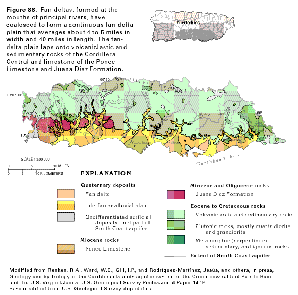
Figure 88 Map showing the geological structure of the
alluvium that composes the South Coast aquifer (41K)
 editable eps file N088.eps.gz
(235K compressed)
editable eps file N088.eps.gz
(235K compressed)
Figure 89 Cross sectional diagram showing
the geological structure of the South Coast aquifer (21K)
 editable eps file N089.eps.gz
(67K compressed)
editable eps file N089.eps.gz
(67K compressed)
Figure 90 Map showing the percentage of
sand in sediments that compose the South Coast aquifer (25K)
 editable eps file N090.eps.gz
(112K compressed)
editable eps file N090.eps.gz
(112K compressed)
Figure 91 Map showing approximate hydraulic
conductivities in the South Coast aquifer (23K)
 editable eps file N091.eps.gz
(114K compressed)
editable eps file N091.eps.gz
(114K compressed)
 editable eps file N088.eps.gz
(235K compressed)
editable eps file N088.eps.gz
(235K compressed) 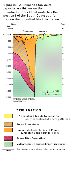 editable eps file N089.eps.gz
(67K compressed)
editable eps file N089.eps.gz
(67K compressed) 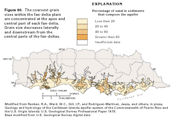 editable eps file N090.eps.gz
(112K compressed)
editable eps file N090.eps.gz
(112K compressed) 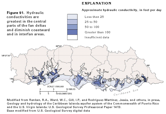 editable eps file N091.eps.gz
(114K compressed)
editable eps file N091.eps.gz
(114K compressed)