GROUND WATER ATLAS of the UNITED STATES
Alaska, Hawaii, Puerto Rico and the U. S. Virgin Islands
HA 730-N
Puerto Rico and the U. S. Virgin Islands Regional Summary
There are two different files for each illustration
- A 72 ppi GIF file, suitable for screen viewing is accessed
through the thumbnail image.
- An eps file, suitable for downloading to be printed or edited
is accessed through the "eps file" link. Most files
are Adobe Illustrator 6.0, exceptions are noted. These files
have been compressed with GNU's gzip utility. If your web browser
defaults to a screen display of the file, turn on the "Load
to local disk" option before downloading. Download and process
these eps files as ascii, not binary.
Introduction
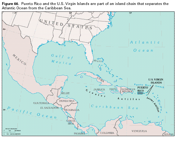
Figure 66 Map showing the location of Puerto Rico and
the Virgin Islands (32K)
 editable eps file N066.eps.gz
(143K compressed)
editable eps file N066.eps.gz
(143K compressed)
Figure 67 Map showing topography of Puerto
Rico and the Virgin Islands (28K)
 editable eps file N067.eps.gz
(91K compressed)
editable eps file N067.eps.gz
(91K compressed)
Figure 68 Graphs showing rainfall amounts
in three different areas of the Puerto Rican islands (12K)
 editable eps file N068.eps.gz
(14K compressed)
editable eps file N068.eps.gz
(14K compressed)
Figure 69 Maps showing average annual rainfall
in Puerto Rico and the Virgin Islands from 1951-1980 (34K)
 editable eps file N069.eps.gz
(376K compressed)
editable eps file N069.eps.gz
(376K compressed)
Figure 70 Map showing average annual runoff
in Puerto Rico from 1951-1980 (23K)
 editable eps file N070.eps.gz
(71K compressed)
editable eps file N070.eps.gz
(71K compressed)
 editable eps file N066.eps.gz
(143K compressed)
editable eps file N066.eps.gz
(143K compressed) 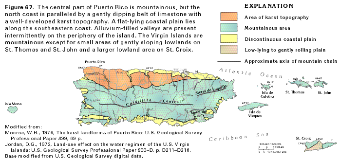 editable eps file N067.eps.gz
(91K compressed)
editable eps file N067.eps.gz
(91K compressed) 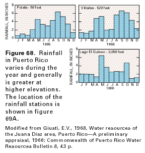 editable eps file N068.eps.gz
(14K compressed)
editable eps file N068.eps.gz
(14K compressed) 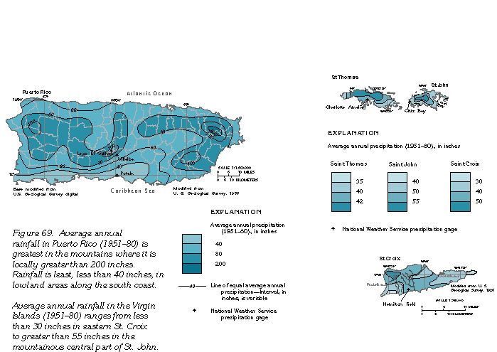 editable eps file N069.eps.gz
(376K compressed)
editable eps file N069.eps.gz
(376K compressed)  editable eps file N070.eps.gz
(71K compressed)
editable eps file N070.eps.gz
(71K compressed)