![]()
Map sheets 1 through 4 are presented here in Adobe Acrobat® PDF (portable document format) only. You will need Adobe Acrobat Reader® Version 4.0 or higher installed on your computer to view or print these documents. If you don't already have this free viewing software, download Adobe Acrobat Reader®.
Note to users with visual disabilities: The PDF files presented here have not been optimized for use with screen readers that support this format. Users with visual disabilities are encouraged to contact Timothy T. Bartos, (307) 778-2931, ext. 2875, for assistance in using the data presented in the report. You may also want to visit the Adobe Systems Accessibility Website, which offers conversion tools and information to help make PDF files accessible.
The entire report may also be ordered from: http://mapping.usgs.gov/esic/to_order.html#pubs
| All map sheets measure 34" tall by 42" wide, and are optimized for printing on a large-format color printer. | |
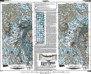
Sheet 1: Potentiometric Surfaces of the Minnelusa and Madison Aquifers
(northern part of the study area). |
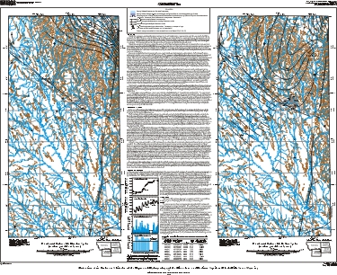 Sheet
2: Potentiometric Surfaces of the Minnelusa and Madison Aquifers
(southern part of the study area). |
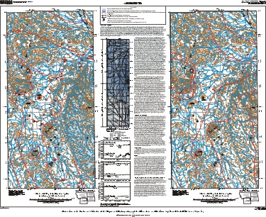
Sheet 3: Altitude of the Tops of the Minnelusa and Madison Aquifers
(northern part of the study area). |
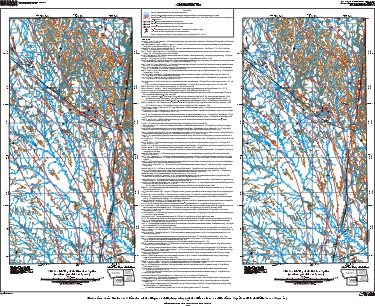
Sheet 4: Altitude of the Tops of the Minnelusa and Madison Aquifers
(southern part of the study area). |