U.S. Geological Survey Geologic Investigations Series I–2673
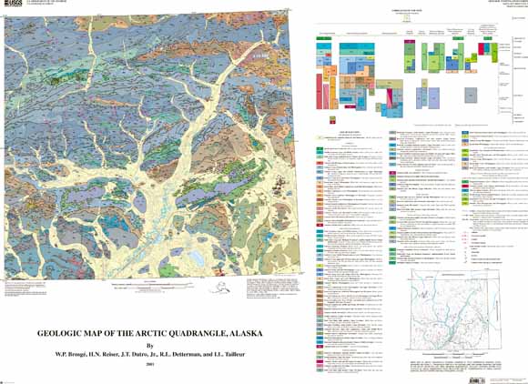
Geologic map
The Arctic quadrangle is well located to shed light on the basic geologic relations of northern Alaska. The rocks represent all of the stratigraphic systems from Cambrian to Cretaceous and all but one of the tectono-stratigraphic subterranes of the Brooks Range, from the autochthonous subterrane in the north to the allochthonous subterranes farther south.
Among the distinctive geologic features displayed in the Arctic quadrangle are voluminous volcanic rocks of probable Devonian age, a wide array of Carboniferous carbonate facies in the Lisburne Group (which here extends up into the Middle Pennsylvanian), the southward transition of Upper Devonian (Famennian) clastic facies from fluvial conglomerate to marine sandstone, a full display of Upper Devonian (Frasnian) reef-related strata, and fossiliferous Ordovician rocks in both carbonate and chert terranes. Most of the quadrangle is in the Arctic National Wildlife Refuge (ANWR) and Arctic Wildlife Refuge Wilderness. The quadrangle also includes Arctic Village, the only village in the region and a potential destination or transfer point for visitors to the wildlife refuge.
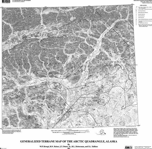
Generalized terrane map
Files available for download:
i2673_sh1.pdf PDF file of Geologic map of the Arctic Quadrangle. Scale 1:200,000. Size 45 x 34 inches (6.1 MB)
i2673_sh2.pdf PDF file of generalized terrane map of the Arctic Quadrangle. Scale 1:200,000. Size ~30 x ~29 inches (4.6 MB)
i2673_sh1_90.eps Download an EPS version of this map (sheet 1) for plotting on a 36-inch-wide plotter (33.5 MB)
i2673_sh1.eps EPS file of geologic map of the Arctic Quadrangle. Scale 1:200,000. Size 31.5 x 31 inches (34 MB)
i2673_sh2.eps EPS file of geologic map of the Arctic Quadrangle. Scale 1:200,000. Size 48 x 36 inches (20 MB)
i2673pamphlet.pdf Pamphlet to accompany map; contains description of map units (38 pages; 201 kb)
For questions about this report, email Tom MooreDownload a free copy of Adobe Reader.
This report is also available in printed form by writing:
USGS Information Services
Box 25286, Federal Center
Denver, CO 80225
Telephone: 1-888-ASK-USGS
E-mail: infoservices@usgs.gov

![]() U.S. Department of the Interior |
U.S. Geological Survey
U.S. Department of the Interior |
U.S. Geological Survey
URL: http://pubsdata.usgs.gov/pubs/imap/i2673/index.html
Page Contact Information: GS Pubs Web Contact
Page Last Modified: Wednesday, 30-Nov-2016 17:39:08 EST
