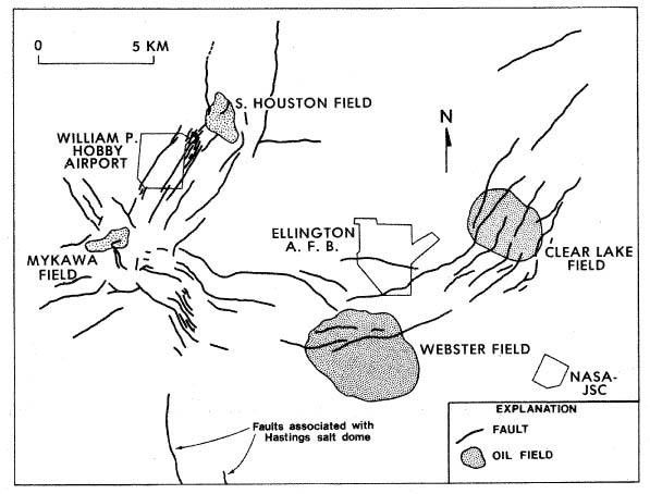
Figure 1. Faults in southeast Houston metropolitan area (modified from Verbeek and Clanton, 1978). All faults shown have been mapped at land surface; many are demonstrably active.
Figure 2 | Contents | Back to Text