
U.S. Geological Survey Miscellaneous Field Studies Map MF-2325-B
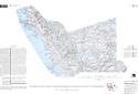
Map Showing Locations of Damaging Landslides in Alameda County, California, Resulting From 1997-98 El Niño Rainstorms
By Jeffrey A. Coe, Jonathan W. Godt, Dianne Brien, and Nicolas Houdre
Version 1.0

This map is presented in Portable Document Format.
Adobe Acrobat Reader 4.0™ is required to view it.
If you wish to download Acrobat Reader 4.0 free of charge, click here.
Map (3-MB PDF file)
Pamphlet to accompany map (1.5-MB PDF file)
Metadata (3-KB text file)