
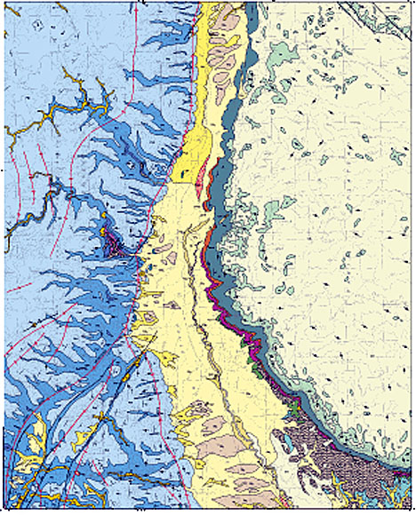
This illustration is a non-navigible .gif image of the USGS geologic map plot of the House Rock Spring quadrangle
This geologic map is part of a cooperative project between the U.S. Geological Survey and the Kaibab National Forest Service to provide geologic information for the Paradine Plains Cactus (Pediocactus pardinei Benson, 1957) Conservation Assessment and Strategy conducted by the Kaibab National Forest, Williams, Arizona. The map area includes part of House Rock Valley and part of the Kaibab Plateau, sub-physiographic provinces of the Colorado Plateau. This part of the Colorado Plateau was not previously mapped in adequate geologic detail. This map completes one of several remaining areas where uniform quality geologic mapping was needed. The geologic information in this report may be useful to future biological studies, land management, range management, and flood control programs for all federal, state, and private agencies.
The map area is in the North Kaibab Ranger District of the Kaibab National Forest and the Arizona Strip Field Office of the Bureau of Land Management (BLM). The nearest settlement is Jacob Lake about 8 km (5 mi) west of the map area. Elevations range from about 2,305 m (7,560 ft) on the Kaibab Plateau in the northwest corner of the map area to about 1,555 m (5,100 ft) in House Rock Valley in the east-central edge of the map area. Primary vehicle access is by U.S. Highway 89A in the northern part of the map area. Four-wheel-drive roads access most of the map area. Dirt roads are not passable in winter snow conditions.
The Bureau of Land Management Arizona Strip Field Office in St. George, Utah manages the public lands, and the North Kaibab Ranger District in Fredonia, Arizona manages the U.S. National Forest system land. Other lands include one quarter of a section belonging to the State of Arizona, about 0.7 of a section of private land, and about 1.5 sections within the BLM-administered Paria Canyon-Vermilion Cliffs Wilderness Area. The private land is in House Rock Valley near State Highway 89A.
Lower elevations within upper House Rock Valley support a sparse growth of cactus, grass, and a variety of desert shrubs. Sagebrush, grass, cactus, cliffrose bush, pinion pine trees, juniper trees, ponderosa pine, and oak trees thrive at elevations above 1,830 m (6,000 ft).
Surface runoff in the map area drains eastward toward the Colorado River through House Rock Valley and into Marble Canyon of the Colorado River at Mile 17 (17 miles downstream from Lees Ferry, Arizona).
hrsmap.pdf - PDF (Portable Document Format) file of the map sheet for viewing onscreen (1.2 MB).
hrsmap.eps - EPS (Encapsulated PostScript) file of the map sheet designed for plotting on a large format plotter. The map is 34 x 34 inches in size (13.6 MB).
hrsgeo.pdf - PDF file of the accompanying map pamphlet for viewing and printing (248 kb).
hrsgeo.txt - An ASCII text file of accompanying map pamphlet (56 kb).
hrspdf.zip - WinZipped file containing two PDF files; the map sheet and the accompanying pamphlet (1.4 MB).
hrseps.zip - WinZipped file containing two files; the map sheet as an EPS file and the accompanying pamphlet as a Microsoft Word document (2 MB).
readme.txt - An ASCII text file explaining contents of digital database and all other files that make up this publication (4 kb).
hrs.met.txt - FGDC-compliant metadata for the database. An additional copy of this file is included with the WinZipped compilation of the database (32 kb).
hrsdb.zip - WinZipped compilation of all files necessary to recreate the database originally assembled in Arc/Info. Included is an AML called import.aml that will automatically import the Arc export files making up this database package (4 MB).
houserockspring.style - ArcMp style for map colors and symbolizing data (584 kB).
Mf2367_shapefiles.zip - Shapefiles and readme describing content of each file (4.9 MB).
For questions about the scientific content of this report, contact George Billingsley
Download a free copy of Adobe Reader
This report is available via print on demand.
| Help
| PDF help |
| Publications main page
| Miscellaneous Field Studies Maps |
| Department of the Interior
| U.S. Geological Survey |
| Geologic Division
| Western Earth Surface Processes Team|
| Privacy Statement
| Disclaimer
| Accessibility |
URL of this page is:
https://pubs.usgs.gov/mf/2001/2367/
Please send comments and suggestions, or report problems, to:
Michael Diggles
Created: July 3, 2001 (cad)
Updated: June 4, 2007 (bwr, mfd)