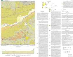
Geologic Map of the Clifton Quadrangle, Mesa County, Colorado
By Paul E. Carrara
Version 1.0

U.S. Geological Survey Miscellaneous Field Studies Map MF-2359
Version 1.0
![]()
This map is presented in Portable Document Format.
Adobe Acrobat Reader 4.0™ is required to view it.
If you wish to download Acrobat Reader 4.0 free of charge, click
here.

Download archive files:
ZIPed archive of ArcInfo and other files (899 KB)
GZIPed TAR archive of ArcInfo and other files (903 KB)
ZIPed archive of base map (3.9 MB)
![]()