U.S. Geological Survey Geologic Investigations Series I–2344
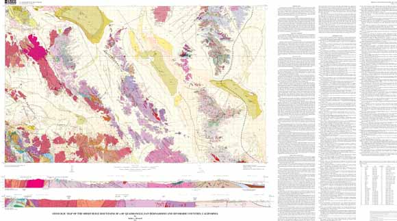
Proterozoic granitoids in the quadrangle include the Early Proterozoic Fenner Gneiss, Kilbeck Gneiss, Dog Wash Gneiss, granite of Joshua Tree, the (highly peraluminous granite) gneiss of Dry Lakes valley, and a Middle Proterozoic granite. Proterozoic supracrustal rocks include the Pinto Gneiss of Miller (1938) and the quartzite of Pinto Mountain. Early Proterozoic orogeny left an imprint of metamorphic mineral assemblages and fabrics in the older rocks.
A Cambrian to Triassic sequence deposited on the continental shelf lies above a profound nonconformity developed on the Proterozoic rocks. Small metamorphosed remnants of this sequence in the quadrangle include rocks correlated to the Tapeats, Bright Angel, Bonanza King, Redwall, Bird Spring, Hermit, Coconino, Kaibab, and Moenkopi formations. The Dale Lake Volcanics (Jurassic), and the McCoy Mountains Formation of Miller (1944)(Cretaceous and Jurassic?) are younger Mesozoic synorogenic supracrustal rocks in the quadrangle.
Mesozoic intrusions form much of the bedrock in the quadrangle, and represent a succession of magmatic arcs. The oldest rock is the Early Triassic quartz monzonite of Twentynine Palms. Extensive Jurassic magmatism is represented by large expanses of granitoids that range in composition from gabbro to syenogranite. They include the Virginia May Quartz Monzonite and other members of the Bullion Intrusive Suite, the Chubbock Porphyry, and rocks that form the Goat Basin pluton, Music Valley pluton, and Ship Mountains pluton. The Jurassic plutons range in emplacement depths from mid-crustal to hypabysasal. Mafic and felsic dikes that probably are part of the Late Jurassic Independence dike swarm intrude the Jurassic batholithic rocks.
A Mesozoic ductile fault (tectonic slide), the Scanlon thrust, places an inverted sequence of lower Paleozoic rocks and their Proterozoic basement over a lower plate of younger Paleozoic and Triassic rocks. The lower-plate rocks are internally sliced and folded. They in turn are superposed along an attenuation tectonic slide, the Kilbeck fault, over highly strained tectonic schist. The major tectonic slides and associated fabrics are cut by Late Cretaceous batholithic rocks.
Widespread Late Cretaceous granitoids assigned to the Cadiz Valley batholith and the Old-Woman Piute Range batholith together form a contiguous super-unit of granite and granodiorite compositions. The Old-Woman Piute Range batholith includes the granite of Sweetwater Wash in the Painted Rock pluton and the Old Woman Mountains Granodiorite forming the Old Woman pluton. The large Cadiz Valley batholith is divided into the Iron Mountains Intrusive Suite and the Coxcomb Intrusive Suite. The Iron Mountains Intrusive Suite includes the Granite Pass Granite (which forms the Granite Pass pluton), the Danby Lake Granite Gneiss, and the Iron Granodiorite Gneiss. The Coxcomb Intrusive Suite consists of many units including the Clarks Pass Granodiorite, the Sheep Hole Mountains Granodiorite (forms the Sheep Hole Mountains pluton), and the Sheep Hole Pass Granite (forms the Sheep Hole Pass pluton). The Cretaceous rocks were emplaced at a range of deep to shallow depths, and their intrusion resulted in an aureole 2-3 km wide in older rocks. Mylonitic fabrics developed through a thickness of >1.3 km, together with screens of tectonic schist, record ductile deformation associated with or immediately following batholith emplacement in a plutonic roof zone in the Iron Mountains. Post-plutonic Late Cretaceous mylonitic fabrics were also produced by extensional unroofing off both the western and eastern flanks of the incipient Old Woman Mountains.
A nonconformity above the Cretaceous rocks represents a period of deep erosion and nondeposition before lower Miocene volcanic and clastic rocks were deposited. Early Miocene magmatism is recorded by basanitoid, basalt, and dacite flows as well as dacitic intrusions of a lacolith, a stock, and the Bullion Mountains dike swarm. This magmatism coincided with early Miocene tectonic extensional tilting of rocks in the Calumet Mountains. Younger Neogene deposits of conglomerate, gravel, and breccia, and the demarcation of many of the modern ranges in the quadrangle, probably relate to strike-slip faulting and block rotations in the eastern California shear zone. This zone includes northwest-striking dextral faults and east-striking sinistral faults in the western part of the quadrangle. Faults active in Quaternary time include the Calumet fault, West Calumet fault, Dry Lakes fault, Sheep Hole fault, Cleghorn Lakes fault, Cleghorn Pass fault, Ivanhoe fault, Old Dale fault, Humbug Mountain fault, Dog Wash fault, Twentynine Palms Mountain fault, Pinto Mountain fault, Mesquite Lake fault, and two faults that exhibit Holocene movement, the West Valley Mountain fault and the East Valley Mountain fault.
Late Pliocene basalt in the Deadman Lake volcanic field and Quaternary basalt in the Amboy Crater lava flow and a flow near Lead Mountain record the youngest volcanism. Quaternary surficial deposits of alluvium, playa deposits, and windblown sand underlie more than half the quadrangle. Twenty nine drill holes deeper than 100 m have penetrated the surficial deposits. Mapped sand dune crests strike mostly east to southeast. Brine and salt have been commercially exploited from the playas.
Last modified March 28, 2012
First posted May 8, 2002
For additional information:
Contact Information, Western Region Geology and Geophysics Science Center—Menlo Park
U.S. Geological Survey
345 Middlefield Road, MS-973
Menlo Park, CA 94025-3591
http://geomaps.wr.usgs.gov/
This report is presented in Portable Document Format (PDF); the latest version of Adobe Reader or similar software is required to view it. Download the latest version of Adobe Reader, free of charge.
Howard, K.A., , 2002, Geologic map of the Sheep Hole Mountains 30’ x 60’ quadrangle, San Bernardino and Riverside Counties, California: U.S. Geological Survey Geologic Investigations Series I–2344, scale 1:100,000, available at https://pubs.usgs.gov/mf/2002/2344/.

![]() U.S. Department of the Interior |
U.S. Geological Survey
U.S. Department of the Interior |
U.S. Geological Survey
URL: http://pubsdata.usgs.gov/pubs/mf/2002/2344/index.html
Page Contact Information: GS Pubs Web Contact
Page Last Modified: Thursday, 01-Dec-2016 12:08:43 EST
