
Surficial Geologic Map of the Bettles Quadrangle, Alaska
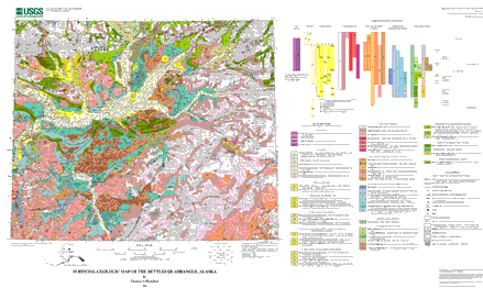 |
| Image showing the Bettles Quadrangle map. Actual map is 41 x 25 inches |
Download this map as a PDF file (6.6 MB)
Download this map as an Encapsulated PostScript file (30.2 MB)
Download the pamphlet for this map as a PDF file (84 KB)
Download an ASCII text file version of the pamphlet, intended for use with screen readers
Download this digital database for this map as a gzipped tar file (3.8 MB)
Download the FGDC-compliant metadata for this report as an ASCII text file (44 KB)
Download a free copy of Adobe Reader
| Help | PDF help | Publications main page | Western MF-maps |
For questions about the content of this report, contact Thomas D. Hamilton
This report is also available via print on demand from
USGS Information
Services, Box 25286,
Federal Center, Denver, CO 80225
telephone: 888-ASK-USGS; e-mail: infoservices@usgs.gov
| Department
of the Interior | U.S. Geological Survey
| Privacy Statement | Disclaimer
| Accessibility |
URL of this
page: https://pubs.usgs.gov/mf/2002/2409/
Maintained by: Michael Diggles
Created: December 4, 2002
Last modified: May 12, 2006 (mfd)
| Privacy Statement | Disclaimer
|
| Department of the Interior | U.S. Geological Survey | Geologic Division | Mineral Resources Team |