
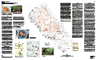
U.S. Geological Survey Miscellaneous Field Studies Map MF-2384
Version 1.0
![]()
This report is presented in Portable Document Format. The latest version of Adobe Acrobat Reader or similar software is required to view it. If you wish to download the latest version of Acrobat Reader free of charge, click here.
Map PDF files for viewing and printing (not Section 508 accessible):
Screen-optimized PDF files (optimized for screen and fast Internet
download):
Sheet 1 PDF file (1.0 MB)
Sheet 2 PDF file (3.9 MB)
Sheet 3 PDF file (133 KB)
Print-optimized PDF files (optimized for printing on digital plotter;
high-resolution; very slow Internet download):
Sheet 1 PDF file (28 MB)
Sheet 2 PDF file (57 MB)
Sheet 3 PDF file (10 MB)
Section 508 accessible map text-only PDF file
Text-only Map PDF file (395 KB)
(This version of the report is accessible as defined in Section 508.)
Metadata file:
Metadata TEXT file (18 KB)
Download GIS file:
ArcInfo Export file (571 KB)
High-resolution plots of this map can be purchased from Information Services, U.S. Geological Survey (1-888-ASK-USGS).
![]()