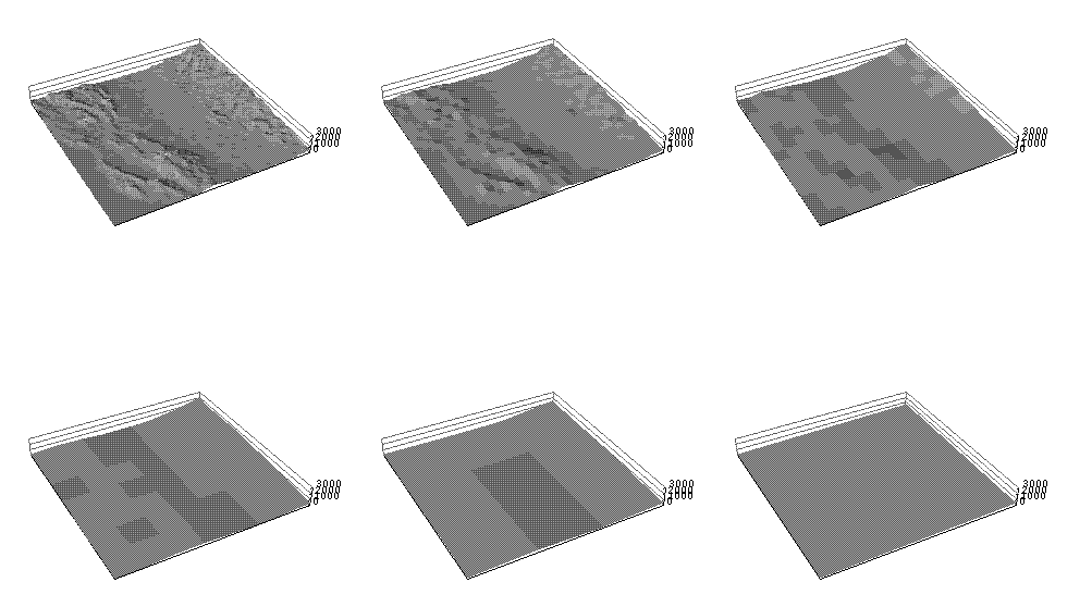
These 6 perspective shaded relief images of the SanSac study area begin at the upper left with 2-km elevation cells and aggregate to 64-km cells. At each step more detail is lost, but at the gain of 75 percent less data volume. The last picture is at about the resolution of a state-of-the-art global climate model.