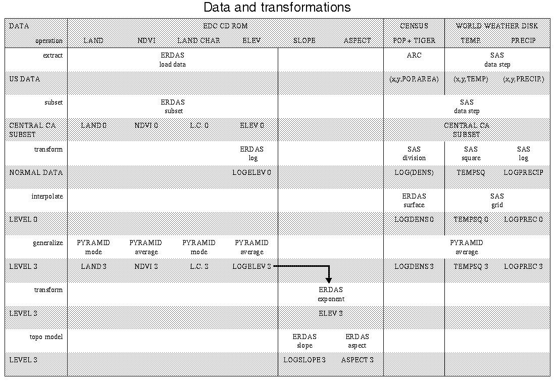
The simplest way to analyze these data was to
transform
all of the measurements into a 1-km (or lower resolution) grid, both to bring them into registration with the AVHRR data sets and to facilitate statistical analysis. It was straightforward to transform the basic AVHRR data (land/water, elevation, NDVI, and land characterization) from the CD-ROM files into a pyramid of 1, 2, 4, . . . , 1,024-km cells. Slope and aspect were also computed for the level-3 (8-km) data.
The Census data were more complex. The populations of each block group were associated with a centroid and then interpolated using a cubic spline to create a 1-km grid and then aggregated using PYRAMID software (De Cola and Montagne, 1993). A similar approach was used for the temperature and precipitation data. In each case, appropriate transformations were made to decrease the assymetry of the distributions.