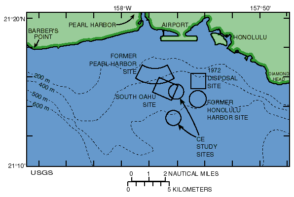
Torresan, M.E., Hampton, M.A., Gowen, M.H., Barber, Jr., J.H., Zink, L.L., Chase, T.E., Wong, F.L., Gann, J.T., and Dartnell, P., 1995, Final report: acoustic mapping of dredged material disposal sites and deposits in Mamala Bay, Honolulu, Hawaii: U.S. Geological Survey Open-file Report 95-17.

| Top of page | Beginning of OFR 95-17 |
![[Reports]](images/nav_rprt.gif) |
![[Honolulu]](images/nav_hono.gif) |
![[Home]](images/nav_home.gif) |
![[Search]](images/nav_srch.gif) |
 |
URL: https://pubs.usgs.gov/of/1995/of95-017/fig02.html
Maintained by: Michael Diggles
Author: Florence L. Wong
Last modified: May 27, 2005 (mfd)
![[ Link to USGS home page ]](images/wrcmgbnr.gif)