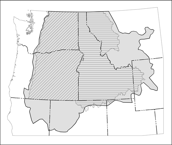

Index map showing location of ICBEMP study area (from figure 1).
Files available for download:
View the ReadMe file: (56 kb).
Download Open-File Report 95-690 as a 24-page Adobe Acrobat PDF file (248 KB).
Download the Geology Dataset in compressed (idgeol.e00.Z) Arc/Info Export format: (3.7 MB download file that will become 8.4 MB when it is uncompressed).
Download the Faults Dataset in compressed (idfaults.e00.Z) Arc/Info Export format: (547 kb download file that will become 1.3 MB when it is uncompressed).
For questions about the scientific content of this report, contact Pamela Dunlap.
For additional information:
Contact Information, Western Mineral Resources Science Center, Spokane Office
U.S. Geological Survey
904 W. Riverside Ave., Room 202
Spokane, WA 99201
http://minerals.usgs.gov/west/
Download a free copy of the latest version of Adobe Reader.
USGS Information Services
Box 25286 Federal Center
Denver, CO 80225
Telephone: 1-888-ASK-USGS
E-mail: infoservices@usgs.gov
| Help
| PDF help |
| Publications main page
| Open-file reports [on line] |
| Department of the Interior
| U.S. Geological Survey |
| Geologic Division
|Western Mineral Resources|
| Privacy Statement
| Disclaimer
| Accessibility |
The URL for this page is: https://pubs.usgs.gov/of/1995/of95-690/
Please send comments and suggestions, or report problems, to:
Michael Diggles
Updated: January 21, 2010 (bwr, mfd)