Open-File Report 96-517


[click on logos to go to agency pages]
Kathleen M. Hodgkinson, Ross S. Stein, Kenneth W. Hudnut, Jay Satalich and John H. Richards*
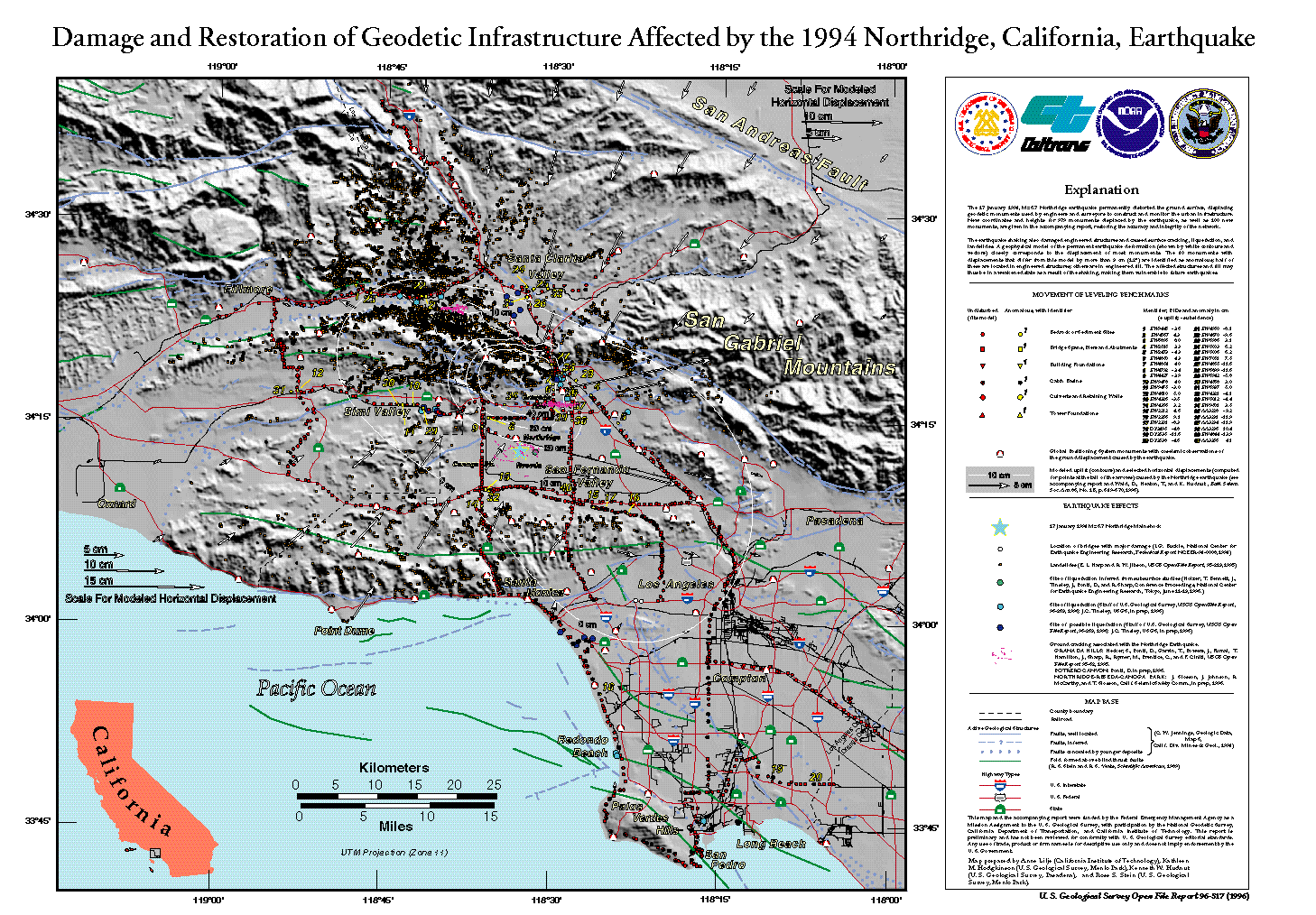
[click on map for medium resolution image (284 kB)]
[click HERE for high resolution image (4.1 MB)]
1. LEVELING ANALYSIS
2. MODELING OF THE EARTHQUAKE DEFORMATION
3. FINDINGS
4. VALUE OF THE REPORT
5. RECOMMENDATIONS
6. REFERENCES
APPENDICES
Detailed Table of Contents
This report is preliminary and has not been reviewed for conformity with U. S. Geological Survey editorial standards. Any use of trade, product, or firm names is for descriptive purposes only and does not imply endorsement by the U. S. Government.
This report recommends improving our ability to assess and restore damaged infrastructure after future earthquakes by increasing efforts to precisely monitor engineered structures. With Los Angeles County, the USGS is now in the second year of a pilot study, GPS monitoring of Pacoima Dam. New GPS and computing technologies make very high precision, near real-time monitoring of critical engineered structures possible.

![]() U.S. Department of the Interior |
U.S. Geological Survey
U.S. Department of the Interior |
U.S. Geological Survey
URL: http://pubsdata.usgs.gov/pubs/of/1996/0517/fema/index.html
Page Contact Information: GS Pubs Web Contact
Page Last Modified: Wednesday, 07-Dec-2016 16:08:09 EST
