By Marvin M. Abbott, Donna Runkle, and Alan Rea
U.S. Geological Survey Open-File Report 96-444
Prepared in cooperation with the
State of Oklahoma, Office of the Secretary of Environment
Oklahoma City, Oklahoma
1997
The data sets in this report include digitized aquifer boundaries and maps of hydraulic conductivity, recharge, and ground-water level elevation contours for the Vamoosa-Ada aquifer in east-central Oklahoma. The Vamoosa-Ada aquifer is an important source of water that underlies about 2,320-square miles of parts of Osage, Pawnee, Payne, Creek, Lincoln, Okfuskee, and Seminole Counties. Approximately 75 percent of the water withdrawn from the Vamoosa-Ada aquifer is for municipal use. Rural domestic use and water for stock animals account for most of the remaining water withdrawn. The Vamoosa-Ada aquifer is defined in a ground-water report as consisting principally of the rocks of the Late Pennsylvanian-age Vamoosa Formation and overlying Ada Group. The Vamoosa-Ada aquifer consists of a complex sequence of fine- to very fine-grained sandstone, siltstone, shale, and conglomerate interbedded with very thin limestones. The water-yielding capabilities of the aquifer are generally controlled by lateral and vertical distribution of the sandstone beds and their physical characteristics. The Vamoosa-Ada aquifer is unconfined where it outcrops in about an 1,700-square-mile area (D'Lugosz and others, 1986).
The Vamoosa Formation is underlain by the Tallant and Barnsdall Formations in the northern part of the aquifer and the Hilltop and Belle City Formations in the southern part of the aquifer. The Ada Group in overlain by the Vanoss Group. The Vamoosa-Ada aquifer is overlain by alluvial and terrace deposits in some parts of the aquifer (Cederstrand, 1996a, 1996b, 1996c).
Most of the lines in the aquifer boundary, hydraulic conductivity, and recharge data sets were extracted from published digital geology data sets (Cederstrand, 1996a, 1996b, 1996c). The lines in the digital geology data sets were scanned or digitized from maps published at a scale of 1:250,000 and represent geologic contacts. Some of the lines were interpolated in areas where the Vamoosa-Ada aquifer is overlain by alluvial and terrace deposits near streams and rivers. These data sets include only the outcrop area of the Vamoosa-Ada aquifer and where the aquifer is overlain by alluvial and terrace deposits. A line representing the contact between the Vamoosa Formation and the Ada Group is included in these data sets. The hydraulic conductivity value and recharge rate are from a ground-water report about the aquifer by D'Lugosz and others (1986).
The water-level elevation contours were digitized from a mylar map used to publish plate 3, "Map-A, Water-Table Surface in Unconfined Part of Aquifer," by D'Lugosz and others (1986), at a scale of 1:250,000. The water-level elevation contours in this data set extend west of the aquifer outcrop area to areas where Vanoss Group rocks overlie the Ada Group. The data set also includes a water-level elevation contour for a terrace deposit east of the aquifer outcrop near the North Canadian River as shown in D'Lugosz and others (1986, plate 3, Map-A). The data sets provided on this diskette are in ARC/INFO export file format.
Compilation of the data sets was funded under a cooperative Joint Funding Agreement between the U.S. Geological Survey and the State of Oklahoma, Office of the Secretary of Environment.
These data sets were created for a project to develop data sets to support ground-water vulnerability analysis. The objective was to create and document digital geospatial data sets from published reports or maps, or existing digital geospatial data sets that could be used in ground-water vulnerability analysis.
The data sets provided in this report are available in nonproprietary and ARC/INFO export file formats. (See NOTES section.) Files, except those with ".GIF" or ".GZ" extensions, are ASCII format files.
The data sets stored in the generic, public-domain Digital Line Graph (DLG-3) Version 3, Optional format have file extensions of ".DLG". Designed for data interchange, the DLG-3 format allows the simple creation of a vector polygon or line data structure. The topological linkages are explicitly encoded for node, area, and line elements. The files are composed of 8-bit ASCII characters organized into fixed logical records of 80 bytes. A detailed description of the DLG-3 Optional format may be found in the data users guide 3, Digital Line Graphs from 1:2,000,000-scale maps (U.S. Geological Survey, 1990).
The ARC/INFO export files are ASCII files that utilize a proprietary format. The "NONE" compression option was used with the ARC/INFO EXPORT command. The ARC/INFO export files have file extensions of ".E00".
The data set files have ".GZ" extensions and were compressed for distribution. These files need to be uncompressed to access the digital data. The GUNZIP utility is an MS-DOS executable program that will uncompress the data files. To uncompress a file, type at the MS-DOS prompt:
GUNZIP -aN AQBOUND.GZ
This command will uncompress the file and restore its original name. For example: "AQBOUND.DLG" or "AQBOUND.E00".
A documentation file (known as metadata) is provided for each data set. The documentation files comply with the Federal Geographic Data Committee (FGDC) Content Standards for Digital Geospatial Metadata (Federal Geographic Data Committee, 1994). The FGDC-compliant metadata files contain detailed descriptions of the data sets, and include narrative sections that describe the procedures used to produce the data sets in digital form.
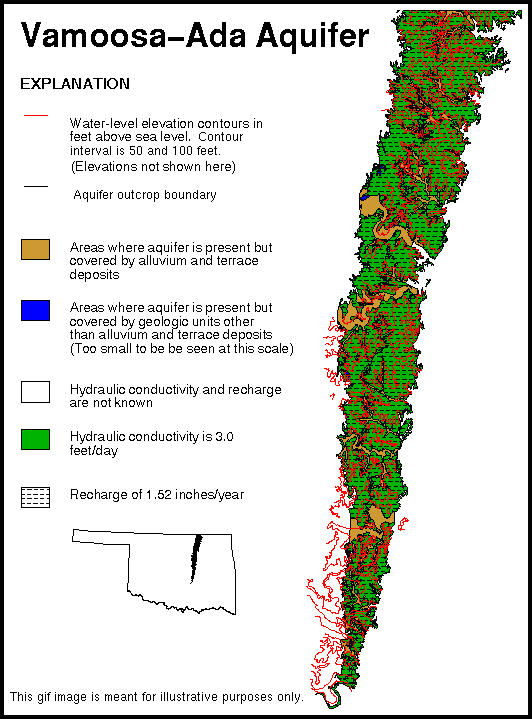
A graphic image also is provided in a Graphics Interchange Format (GIF) file. GIF files are easily displayed on a variety of computer systems that use readily available display software including Internet browser software. This image provides a simplified view of the data sets, and may be used for browsing purposes. The GIF file portrays significantly less spatial resolution and information content than the actual data sets.
No software is provided with these data sets. Users will need GIS software to use the data sets. The U.S. Geological Survey does not recommend or endorse any particular software package for use with these data sets.
The Albers Equal Area map projection (Snyder, 1987) was chosen for the data sets. This projection is appropriate for maps of the conterminous United States because of the visual presentation and equal-area characteristics, which facilitates areal analysis. The projection is cast on the North American Datum of 1983. This projection slightly distorts shapes and distances (scale) in order to maintain equal-area properties. Scale is true along the standard parallels, which are to the north and south of Oklahoma. Scale distortion in Oklahoma reaches a maximum of slightly less than one percent at the northern border of the state. The following table provides map projection information.
| Projection parameters: | |
|---|---|
| Spheroid | GRS1980 |
| Datum | NAD83 |
| First standard parallel | 29 30 00 North |
| Second standard parallel | 45 30 00 North |
| Central meridian | 96 00 00 West |
| Latitude of projection origin | 23 00 00 North |
| Coordinate system parameters: | |
| False easting | 0 |
| False northing | 0 |
| Planimetric units of measure | meters |
Use of trade names is for descriptive purposes only, and does not imply endorsement by the U.S. Government.
ARC/INFO software was used in the development of the data sets. The data sets were processed using the ARC/INFO Revision 7.0.3 software package, running on a Data General AViiON workstation. Further processing was done using ARC/INFO Revisions 7.0.4 and 7.1.1 on a SUN Enterpise 4000 running Solaris Version 2.5.1. File names in this document are enclosed in quotation marks and type set in upper case.
Cederstrand, J.R., 1996a, Digital geologic map of Ardmore-Sherman quadrangles, south-central Oklahoma: U.S. Geological Survey Open-File Report 96-370, based on a scale of 1:250,000, 3 diskettes. (Available in nonproprietary and ARC/INFO formats.)
Cederstrand, J.R., 1996b, Digital geologic map of Enid quadrangle, north-central Oklahoma: U.S. Geological Survey Open-File Report 96-374, based on a scale of 1:250,000, 4 diskettes. (Available in nonproprietary and ARC/INFO formats.)
Cederstrand, J.R., 1996c, Digital geologic map of Oklahoma City quadrangle, central Oklahoma: U.S. Geological Survey Open-File Report 96-378, based on a scale of 1:250,000, 2 diskettes. (Available in nonproprietary and ARC/INFO formats.)
D'Lugosz, J.J., McClaflin, R.G., and Marcher, M.V., 1986, Geohydrology of the Vamoosa-Ada aquifer east-central Oklahoma: Oklahoma Geological Survey Circular 87, 42 p.
Federal Geographic Data Committee, 1994, Content standards for digital geospatial metadata (June 8): Federal Geographic Data Committee, Washington, D.C., 78 p.
Snyder, J.P., 1987, Map projections--A working manual: U.S. Geological Survey Professional Paper 1395, 383 p.
U.S. Geological Survey, 1990, Digital line graphs from 1:2,000,000-scale maps, data users guide 3: U.S. Geological Survey National Mapping Program Technical Instruction, 70 p.
| USGS-Oklahoma |
| AccessibilityFOIAPrivacyPolicies and Notices | |
 |
|