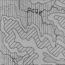
Figure 5A. Typical section from Geology of Chase County (R.C. Moore, 1952).
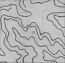
Figure 5B. Results of direct digitizing from Figure 5a superimposed on 1:24,000 topographic map.
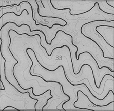
Figure 5C. Results, in the area of Figure 5a, from interpretation of R.C. Moore's map on a 1:24,000 topographic map.