|
Lava-Cooling Operations During the 1973 Eruption of Eldfell Volcano, |
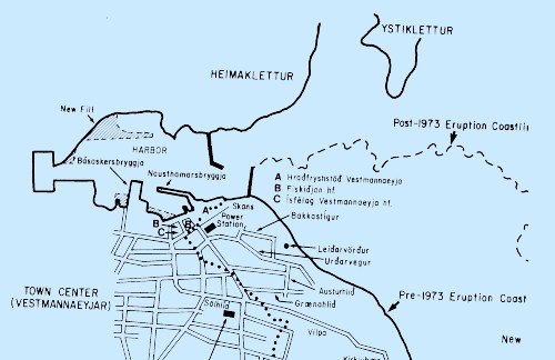
Figure 3.
Sketch map of part of the town of Vestmannaeyjar and northeastern Heimaey, combining the pre-eruptive geography on 15 July 1971, 1.5 years before the Eldfell eruption [map based on 1:5,000-scale image map of Vestmannaeyjar (National Land Survey of Iceland, 1973 a) and special 1:100,000-scale line map of Heimaey and Vestmannaeyjar (National Land Survey of Iceland, 1973b)] with post-eruptive geography on 27 July 1977, four years after the eruption ended [(map based on 1:50,000-scale topographic map and 1:10,000-scale orthophotomap of Heimaey and Vestmannaeyjar, respectively (National Land Survey of Iceland, 1979).]
Click on map to zoom in
|