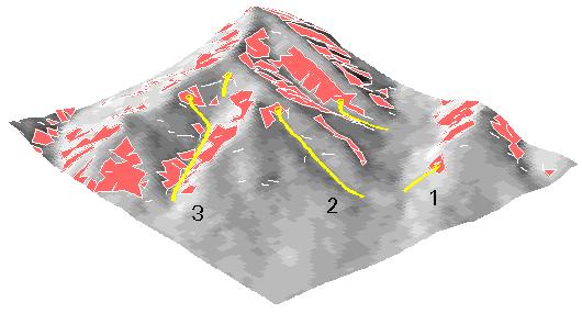
Figure 1: Perspective view showing typical debris flows (yellow)
resulting from a major storm, in relation to potential source areas
(red zones) like those shown on the map. In any one storm only a
small fraction of the potential source areas may be activated. Most
debris flows in the San Francisco Bay region travel only several tens
of yards or less, but some may travel hundreds of yards downslope
from their sources and others have traveled as much as a mile or more
down stream channels. Numbers refer to typical hazardous locations,
such as 1) near the base of steep hillsides, 2) near the mouths of
steep sidehill drainages, and 3) in and near the mouths of canyons
that drain steep terrain.