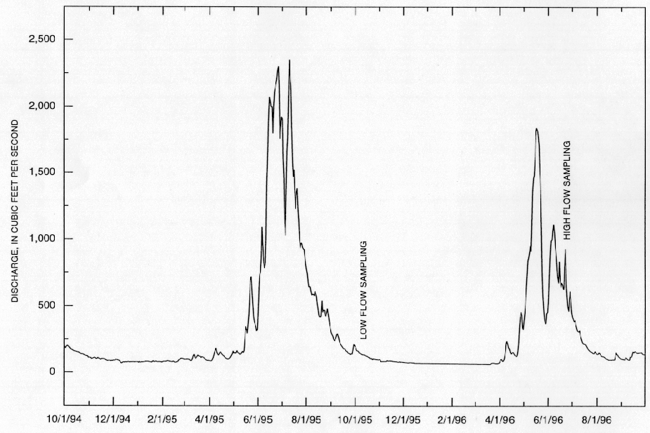
In order to meet the objectives of the study outlined above, new samples were collected for water, colloid, and bed-sediment chemistry in the larger tributaries of Cement and Mineral Creeks and the Animas River to evaluate stream reaches where major sources of metal loading might be expected. This suite of samples was also used to supplement and validate the previous geochemical data set. The initial stream sediment and water sampling was conducted during the week of Oct. 16-20, 1995 during low-flow conditions. Supplementary sampling of the stream sediments was done during the weeks of Aug. 25, 1996, and Oct. 24, 1996, to evaluate annual and seasonal variability. Additional supplementary water sampling was done during snowmelt runoff the weeks of May 9, May 20, and June 20, 1996, to evaluate the dissolved and colloid metal loads under high-flow conditions. A hydrograph showing the stream flow discharge for the period from July 1994 to Oct. 1996 is shown in figure 9. The periods during which water sampling were done are indicated on the hydrograph.
The study in the Animas River basin involved the measurement of selected metals in water, colloids, and bed-sediment samples from the mainstem of the river and from the major tributaries (fig.10). The sampling included six sites near Silverton, Colorado, and fourteen sites downstream between Bakers Bridge and Aztec, New Mexico. Stream flow discharge was measured at the time of sample collection, and samples were collected by equal-width integration across the channel (Ward and Harr, 1990). Ultrafiltration was used to separate the "dissolved" metals from the colloidal phase. Analytical procedures are in appendix II and the analytical results are in appendices III-IV.
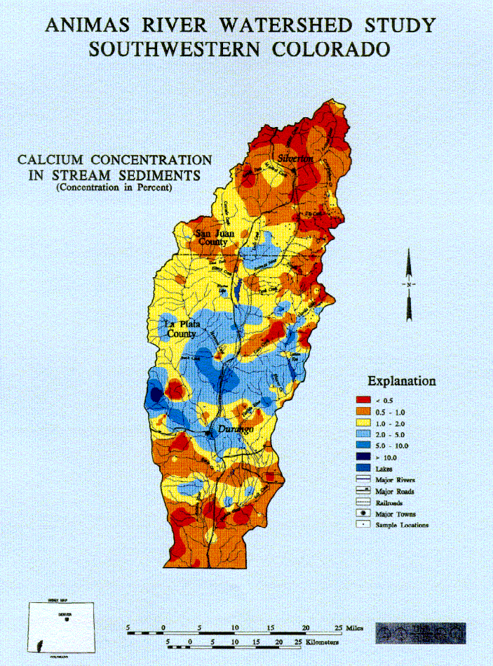


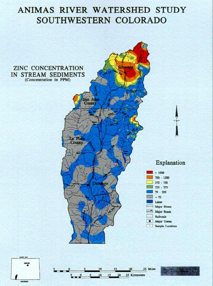
Stream-sediment samples were collected from sites within selected stream reaches to characterize the reach as well as to supplement previous sampling. At individual sites, a sample was composited along 50-100 feet of the stream from several localities on both sides of the stream below the active water line. This composite sample was sieved through a minus-10-mesh stainless steel sieve (2 mm) into a plastic gold pan and 1-2 kg sample of fine-grained sediment was transported to the laboratory. The sample was dried at room temperature (about 20oC) and then sieved to collect the minus-100-mesh (minus-149-mm) grain-size fraction. This minus-100-mesh sample was used for all chemical and lead-isotopic work. Sample localities from Mineral Creek, Cement Creek, and the Animas River are in figure 11. For further details on the sample handling, see appendix I in Church and others (1993). Chemical procedures, analytical precision, and reproducibility are discussed in appendix II and the analytical results are in appendices V-VII.
Additional samples of overbank sediments, composed of fine-grained sand and silt sediments deposited at high water, were collected in the same manner from the sides of the stream channel to evaluate the effect of wetting and drying of these sediments on the availability of water-soluble metals. These samples were dry-sieved in the field. Some water-soluble efflorescent salts and mill tailings were also collected from along the stream reaches. These special samples are identified and briefly described in the data tables (appendices V and VI).