
![]()
Coal availability in the Hilight quadrangle, Powder River Basin, Wyoming: a prototype study in a western coal field
by Carol L. Molnia, Laura R. H. Biewick, Dorsey Blake, Susan J. Tewalt, M. Devereux Carter (US Geological Survey), and Charlie Gaskill (Bureau of Land Management)
|
Figure 9. Coal-correlation diagram showing representative sections from the Hilight study area. R, Rider Wyodak; M, Main Wyodak; L, Lower Wyodak coal beds, as used in this report. Numbers are in feet; elevations above sea level are shown on right margin of figure. Inset map shows location of sections. 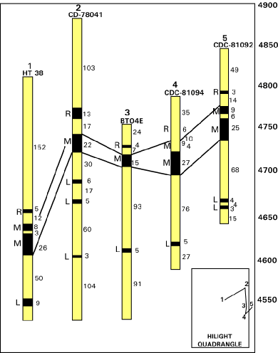 |
U.S. Geological Survey Open-File Report 97-469