
![]()
Coal availability in the Hilight quadrangle, Powder River Basin, Wyoming: a prototype study in a western coal field
by Carol L. Molnia, Laura R. H. Biewick, Dorsey Blake, Susan J. Tewalt, M. Devereux Carter (US Geological Survey), and Charlie Gaskill (Bureau of Land Management)
|
Figure 2. Map showing locations of surface coal mines near the Hilight 7 1 /2 -minute quadrangle. 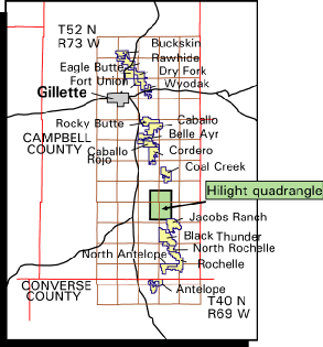
|
Figure 3. Map showing data points used for this study within the Hilight quadrangle and in an area three miles around the quadrangle (approximately 350 points total). The outline of the proposed Keeline coal mine is shown. Line A-A\022 is the trace of the coal-correlation diagram shown in figs. 10 and 11. 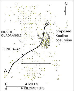
|
U.S. Geological Survey Open-File Report 97-469