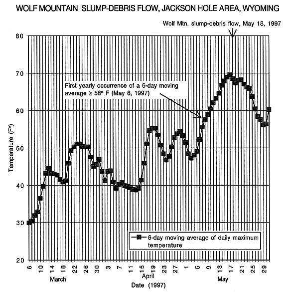
Figure 1.--Example of graphs developed to show that the profiled landslide events are preceded by,or are coincidental with, conspicuous intervals of rising temperatures wherein the 6-day moving average of daily maximum temperature typically reach into the high 50's or higher.
Data used to estimate temperatures at landslide source area:
Lapse rate: -4.5° F/1000 ft
Elevations:
Total temperature correction = -4.1° F
| AccessibilityFOIAPrivacyPolicies and Notices | |
| |
|