CARBON STORAGE AND LATE HOLOCENE CHRONOSTRATIGRAPHY OF A MISSISSIPPI RIVER DELTAIC MARSH, ST. BERNARD PARISH, LOUISIANA
US GEOLOGICAL SURVEY OPEN-FILE REPORT 98-36
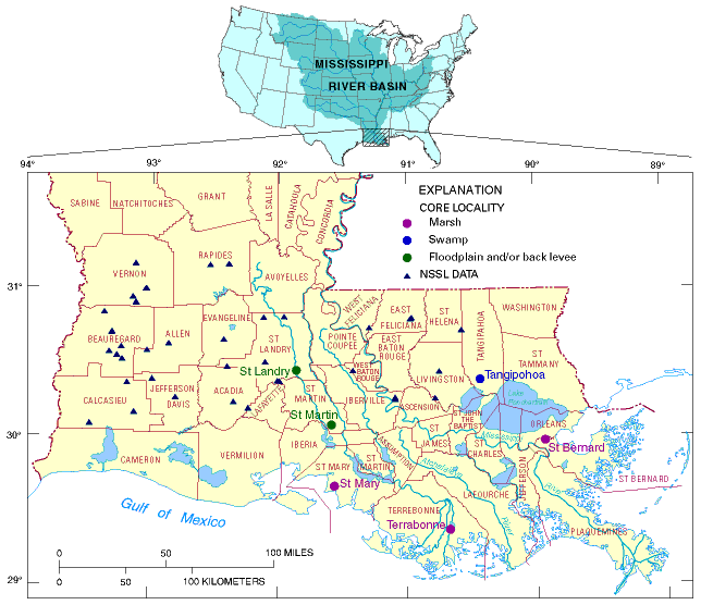
FIGURE 1: The Mississippi River drains an area of 3.3 x 10⁶km2and forms a well-defined bird's foot delta as it enters the Gulf of Mexico. Mississippi Basin Carbon Project core localities in the Mississippi River deltaic plain are indicated by different colored circles: purple, marsh; dark brown, swamp; green, floodplain and (or) back levee. Core locations are named for the parish in which they are located; parish names are shown. The St. Bernard core locality is in the easternmost part of the study area. Triangles indicate localities for which surface and near-surface organic carbon data are available from the National Soil Survey Laboratory in Lincoln, Nebraska (NSSL, 1994).