CARBON STORAGE AND LATE HOLOCENE CHRONOSTRATIGRAPHY OF A MISSISSIPPI RIVER DELTAIC MARSH, ST. BERNARD PARISH, LOUISIANA
US GEOLOGICAL SURVEY OPEN-FILE REPORT 98-36
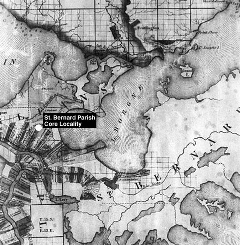
FIGURE 10B. Photograph of 1845 map showing: (1) the position of St. Bernard Parish core locality (white circle) on Conseil Plantation lot, and (2) the railroad (black line that parallels the Mississippi River on the north side and then runs eastward through plantation land) used for transportation of agriculture and wood products. This is a close up of part of map in figure 10A (La Tourrette, 1845).